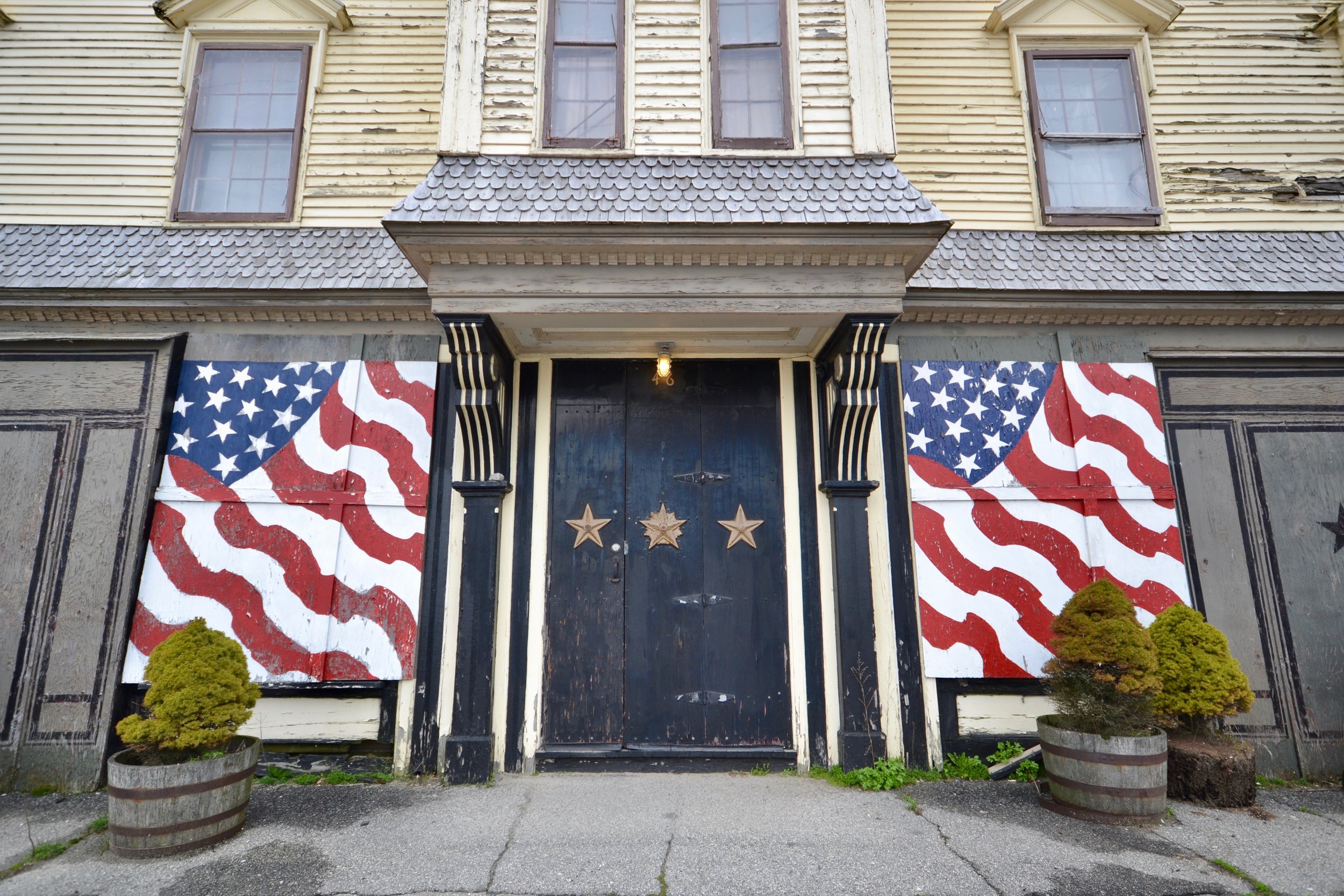
Frances Perkins Homestead, Newcastle (IN MOTION)

The Story

Near the banks of the Damariscotta River in Newcastle sits a modest two-story Greek Revival saltwater farm. The 1837 brick house and connected barn are surrounded by verdant fields, wooded groves and stone walls on property that has been home to the Perkins family for over 250 years. Frances Perkins, the Nation’s first female cabinet officer, summered here from 1880-1965, and devoted her life to public service, most famously as Secretary of Labor from 1933-1945. Perkins accomplished much in this post and is credited as the architect of key provisions of the New Deal, including many programs that helped bring the nation out of the Great Depression. She was instrumental in the establishment of Social Security, the minimum wage, standardizing the 40-hour work week, banning child labor, and developing the nation’s unemployment insurance and worker compensation systems. Throughout her life she found respite at her family’s farm. The property is currently owned by her grandson, who occasionally opens it for tours led by the nonprofit Frances Perkins Center. It was designated a National Historic Landmark in 2014.

 The Threat

While the principal structures of the homestead have survived nobly over 180 years, harsh Maine winters have taken their toll. A recently completed conditions assessment identified deteriorated roofs, windows, doors and exterior brick walls as well as failing posts, floor framing and roof beams, and antiquated mechanical systems. These issues are threatening both the buildings and contents, and significant repairs are required to protect the building and allow it to host visitors as a public educational site. Currently the Frances Perkins Center has a right of first refusal to purchase the property but must raise funds to cover the cost of rehabilitation in addition to the purchase price, before this agreement expires in November 2019.

 The Solution

Help the Frances Perkins Center Board meet its ambitious $5.5 million capital campaign goal of acquiring the property before it’s too late. Preserving this  homestead, Frances Perkins’ “place of the heart,” is a once-in-a-lifetime opportunity. This National Historic Landmark must be rehabilitated to ensure future generations can be inspired by Frances Perkins’ legacy.

Click here to download the citation

Star of Hope, Vinalhaven

The Story

The Star of Hope Lodge, founded in 1874 as the local Independent Order of Odd Fellows, met for generations above the M.K. Kiff store. As the order, members purchased the store and the adjacent building, joining the two and adding the now famous mansard-roofed third floor in 1885. The clapboarded building continued to house retail on the first floor while the second and third floors functioned as meeting space and a lodge hall for the IOOF. Standing proudly on the north side of Main Street it is still one of the largest buildings along the waterfront and a reminder of the prosperity of Vinalhaven’s granite industry. The IOOF used the building until the 1930s, after which a drugstore occupied only the first floor. In 1969 the Order sold the building to noted photographer Eliot Elisofon, and the pop artist Robert Indiana subsequently rented the building. In 1977, after Elisofon’s death, Indiana purchased the property, completing a full restoration in 1981. It was listed in the National Register of Historic Places the following year and Indiana used it as his home and studio until his death in 2018.

 The Threat

Today, the Star of Hope towers over Main Street, but windows are boarded up, there is a tarp over a hole in the roof, and the exterior clapboards and sheathing have deteriorated significantly. Robert Indiana became more reclusive as he aged and, despite his affection for his home of four decades, it fell into a state of decay. His estate is currently embroiled in a federal lawsuit filed by Morgan Art Foundation Limited that alleges individuals close to Indiana have sold his works without proper compensation, forged some artwork as well as isolating and exploiting him. Indiana’s will calls for the Star of Hope to be turned into a museum of his artwork, as well as a public space for lectures and classes. As the current legal battle drags on the building continues to deteriorate.

 The Solution

All parties involved in the administration of Indiana’s estate must ensure that pending legal action does not cause further dangerous deterioration of the building.  This building is the centerpiece of Vinalhaven’s Main Street and its restoration is key to the economic health of the downtown and to the legacy of Robert Indiana. Immediate repair of the roof and windows, and the stabilization of any structural deficiencies will allow the building to be ”mothballed” until the Indiana estate is able to move forward with complete restoration. If nothing is done in the short term, significant exterior and interior features of the Star of Hope will be lost.

Working Waterfront, Boothbay Harbor (IN MOTION)

The Story

Maine’s 3,500-mile shoreline --5,300 miles including islands--is the longest of any state on the East Coast and has helped define the character of the Pine Tree State. Sadly, the latest assessment suggests that only 20 miles of mainland and island shoreline are still considered working waterfront used to support commercial fishing. Maine’s commercial fishing industry brought in $636 million in 2016 – 80 percent from lobstering – supporting 35,000 jobs. Management of what’s left of the state’s historic working waterfront is critical to Maine’s future economy and to our cultural history.

The Threat

 A study by the Maine State Planning Office states that by 2050 most of Maine’s coast will be classified as Suburban/Urban due to economic pressures inducing communities to shift to non-maritime commercial and residential uses. Only eight of the 20 miles of working waterfront are owned and dedicated to use by the public; the remaining 12 miles are privately owned and vulnerable to changing uses.  At any point this land could be developed for hotels, or other commercial or residential uses, permanently removing access for commercial fishermen.

Boothbay Harbor is a prime example. A Maritime District established 30 years ago on the east side of the harbor comprises less than 1% of the land area in the town, yet it houses three of the four wholesale and retail lobstering businesses serving more than 60 lobstermen. The 2015 Town Comprehensive Plan states: “The intention of this land use district is to protect traditional commercial water-dependent uses such as commercial fishing, boatbuilding, marine service and repair, etc., from other competing but incompatible uses; to conserve points of public access to coastal waters; and to give preference in identified areas to commercial water-dependent uses over recreational and residential uses.”

Unfortunately, a rezoning proposal would transform 77 percent of the Maritime District into a Limited Commercial District, allowing for hotels, recreational marinas and housing inconsistent with the intent of the Comprehensive Plan. This zoning change would open a key stretch of working waterfront to economic pressures that could forever alter the historic character of this area, and significantly impact the viability of marine-based industries in Boothbay Harbor.   

The Solution

Waterfront towns, including Boothbay Harbor, should maintain or enhance the protections offered through the State’s Shoreline Zoning to preserve historic working waterfronts. Weakening such protections is counter to the maritime and economic development interests of Maine communities. Stronger protections should cover not only current active working waterfront sites, but also adjoining areas, permitting expanded use and an essential buffer for fragile maritime resources.

Working waterfronts can also be protected more permanently by public acquisition. Voters in Bar Harbor and St. George have recently supported public investment in their historic waterfronts. Fundraising to provide protection through nonprofit-organization ownership is another alternative. The Island Institute, Coastal Enterprises, Inc., Maine Coast Heritage Trust and the Department of Marine Resources have dedicated a tremendous amount of time and research to developing tools and strategies to help communities protect these vulnerable resources. Communities fortunate enough to have historic working waterfronts CAN preserve and enhance these assets through maintaining and augmenting zoning protection, and planning for public and private funding to provide permanent safeguards for Maine’s maritime heritage.

Click here to download the citation

Maine's Historic Dams, Statewide

The Story

Maine is endowed with a remarkable network of rivers with significant flow and elevation change. These rivers have long served as a source of natural power, shaping history, and determining the course of development for Maine’s towns and cities.  

Damming of rivers here began with the first European settlers. Today, more than 1,000 dams remain across the state, vestiges of a time when surging waters and changing tides were used to power mills for grain, lumber, carding and paper mills. Many of our communities have grown up around these early industries. The dams and resulting ponds and reservoirs touted the benefits of flood mitigation, sourcing of drinking water, irrigation, fire control, and the creation of picturesque settings and sites of recreation.  

Modern hydroelectric power plants emerged at these and new sites to supply electricity beyond industrial uses, producing affordable, sustainable energy for businesses, schools, and houses. In 2021, more than a quarter of Maine’s total electricity net generation still originated from hydroelectric power. As of 2022, 51 licensed hydroelectric power plants remain in the state, with a small portion over 100 years old! (Maine State Profile and Energy Estimates, U.S. Energy Information Administration, 2022, https://www.eia.gov/state/analysis.php?sid=ME).      

The Threat

Many of the remaining historic dams no longer serve the purpose for which they were built and have fallen into disrepair, facing uncertain futures. Some communities and individual dam owners are now considering removing dams due to the cost of ongoing maintenance. In addition, dams have created significant fish passage barriers and continue to pose risks to species like Maine’s iconic but endangered Atlantic salmon. Efforts to improve fish passage through the introduction of fish ladders and lifts along the existing dams are also costly. Once thought to help control flooding, research now shows that dam spillways are often inadequately sized to dispense floodwaters, especially given the increase in extreme weather events and precipitation due to climate change. Dams also restrain and inhibit the natural flow of sediment in waterways, which interrupts natural processes that contribute to the maintenance and nourishment of downstream habitats.  

The Solution

Dams are significant elements of our historic built environment that have driven local economies and development, with some persisting as important sources of renewable energy. At the same time, their construction has also proved detrimental to Maine’s environment. As communities and individual dam owners consider the future of these structures, key stakeholders should gather to discuss possible pathways to make informed decisions. For example, many dam sites are important to Maine’s Tribes because of deep connections to rivers and streams. Preservation professionals and local historical societies can be consulted to identify and highlight aspects of the site’s history and engineering, while conservationists and civil engineers can summarize environmental impacts and potential options for improving the overall site for the greatest public benefit. In some cases, it may be possible to preserve a dam while providing alternate routes for fish passage. In others, it may be better to retain and rehabilitate historic gatehouses and other auxiliary structures, or to keep only historic sections of old dams in place. Interpretive signage, interactive digital platforms, and educational programming can contextualize the sites and help share these important histories if complete removal is pursued.   

The Maine Forest and Logging Museum Dam on Blackman Stream in the Penobscot River watershed is a good example of striking the right balance of resources. Logging and milling history was woven together with improved fish passage to enhance the visitor experience to the museum. For years, a series of blockages in the stream had impeded the migration of native alewives, a keystone fish species. Partners came together to design a fishway that fit with the historic character of the site, crafting 17 rock and pool weirs around the dam. A short Denil-style fishway, faced with local rock, was built at the top to moderate the high and low stream flows. Several repairs to the historic dam were also made as part of the project. The fishway has become a key attraction for the thousands of visitors to the museum, while the stream has established a robust alewife run that serves as a crucial food supply to numerous other native species and is a preferred bait among Maine’s lobster fishermen.

UPDATED — July 2023

Click here to download the citation

McGlashan-Nickerson House, Calais (IN MOTION)

rare Homesteader Opportunity

July 2020

Here’s your opportunity to be a homesteader in Maine in a fabulous Downeast location.

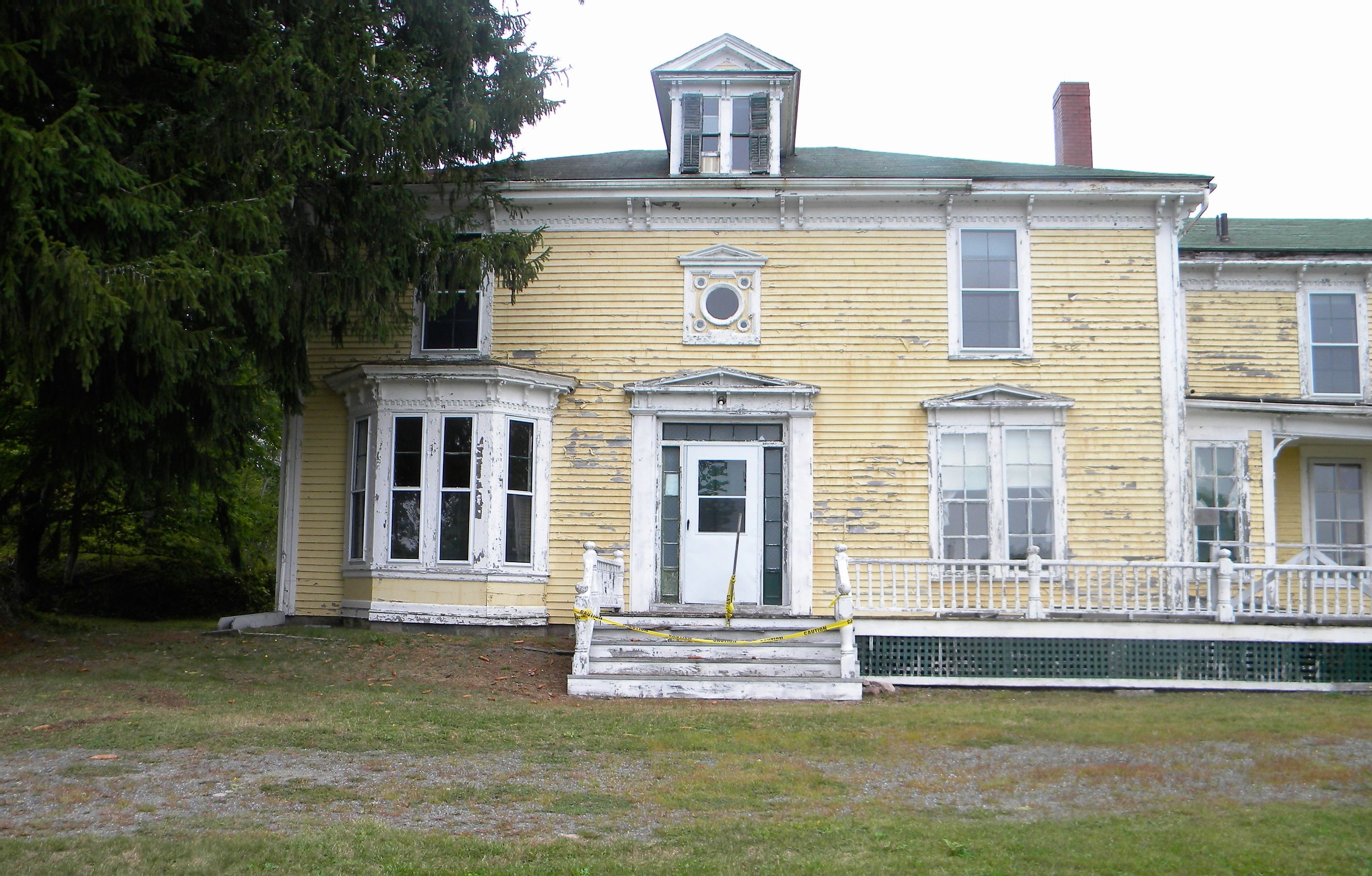
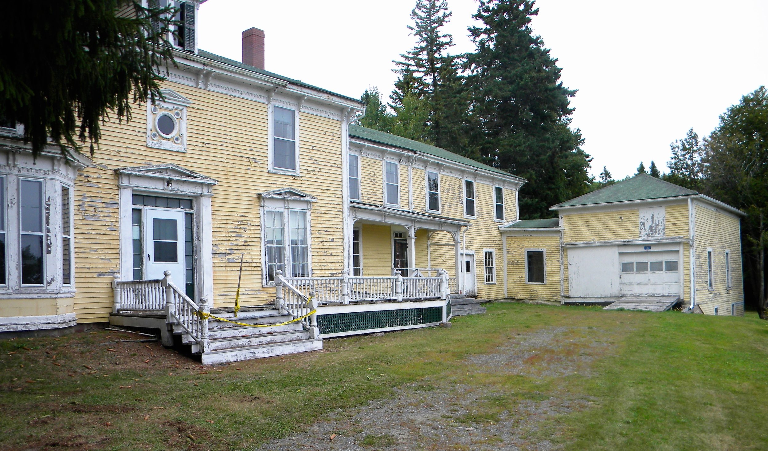
The National Park Service is soliciting proposals to take on the McGlashan-Nickerson House as a long term lease. You bring the repairs, and the property is yours to use essentially rent-free for 60 years. It’s a great opportunity to be a part of something very special.

About the opportunity

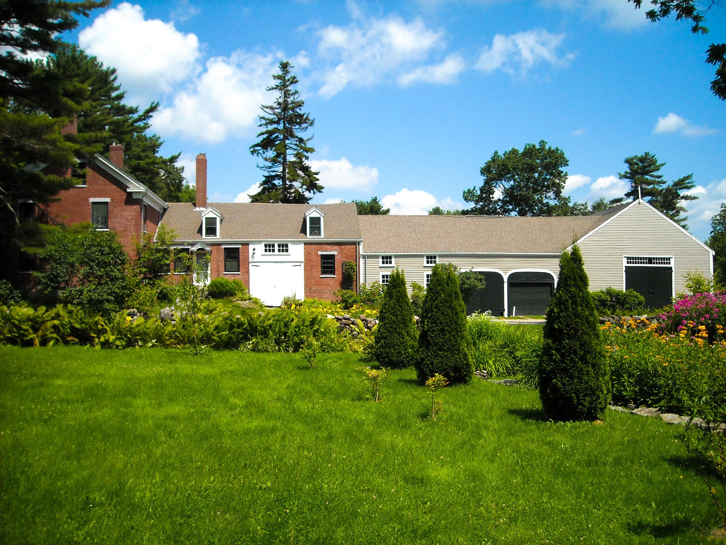
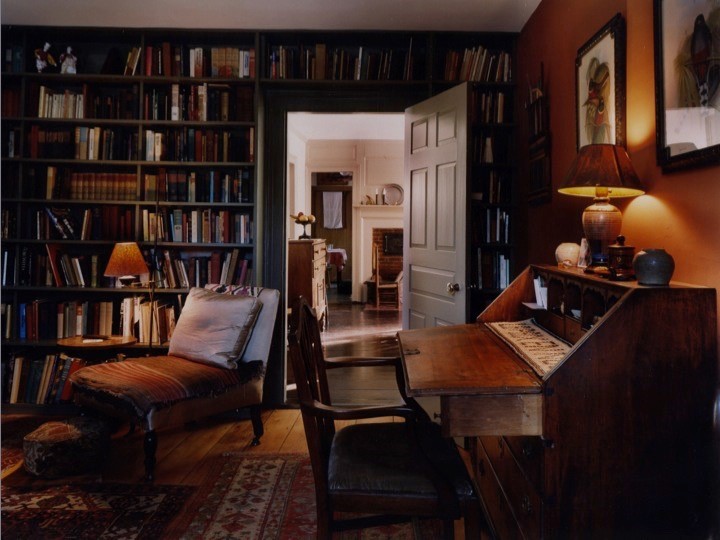
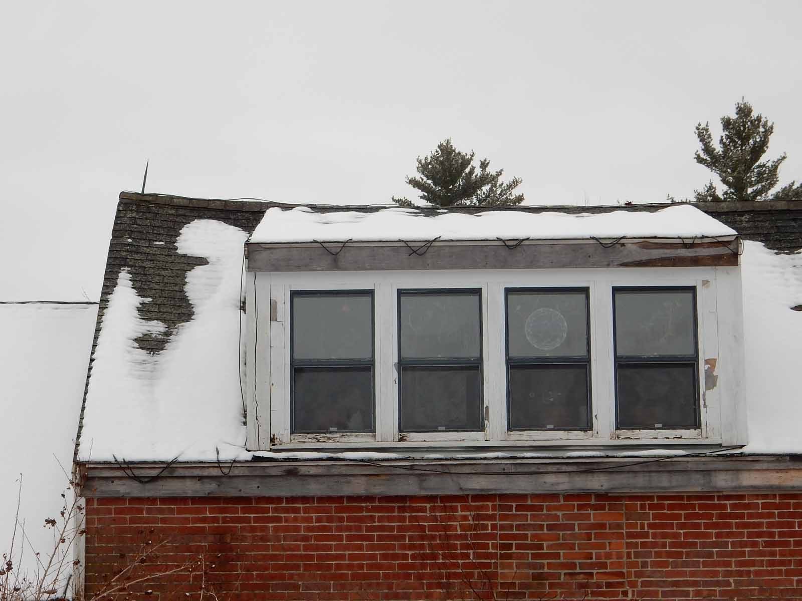
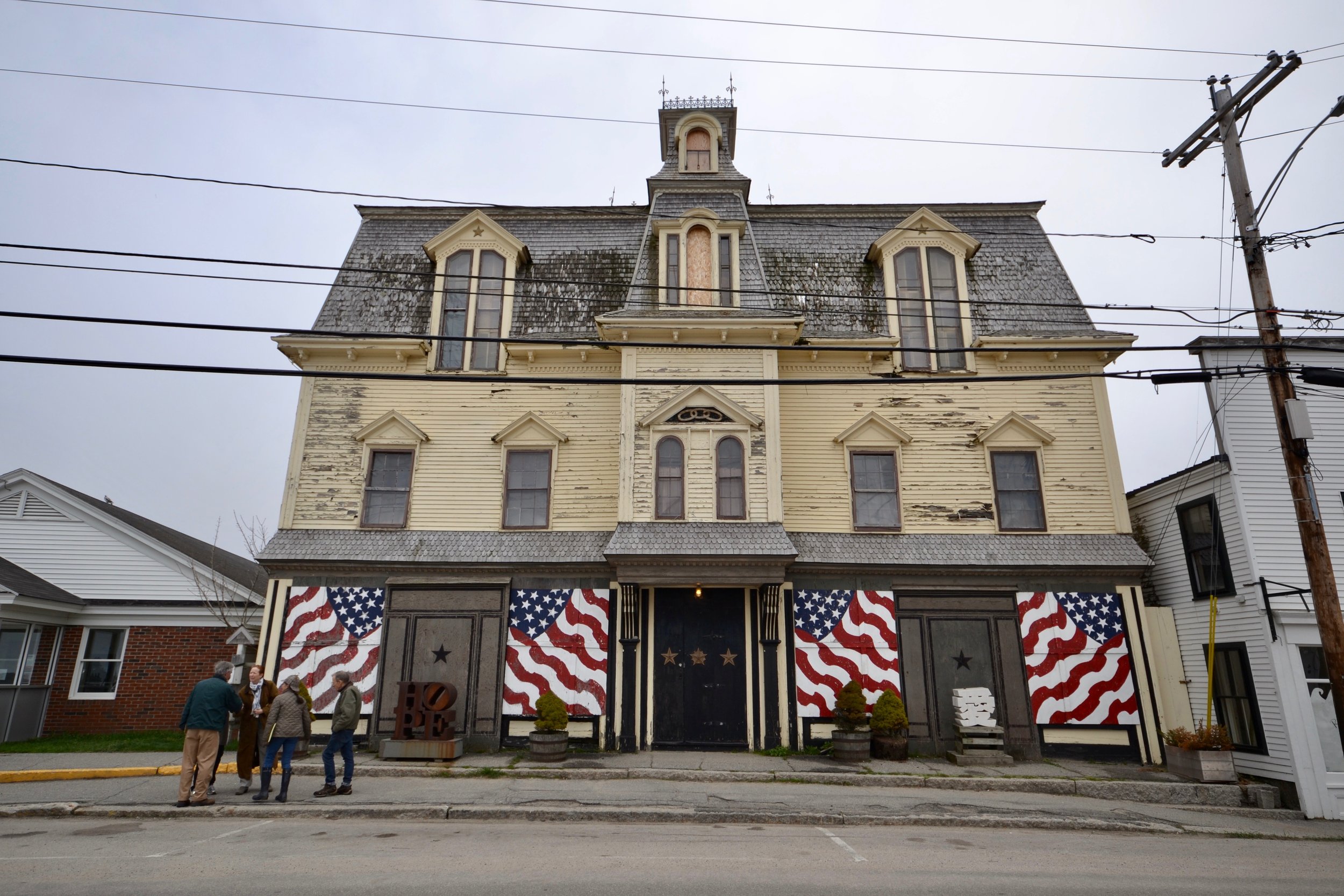
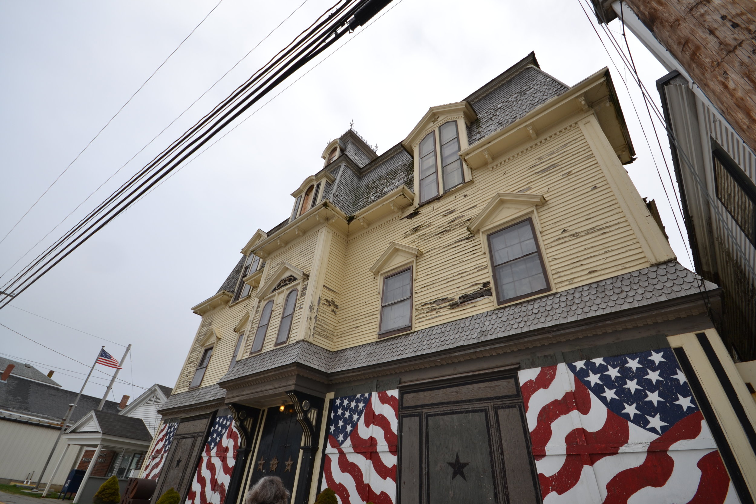
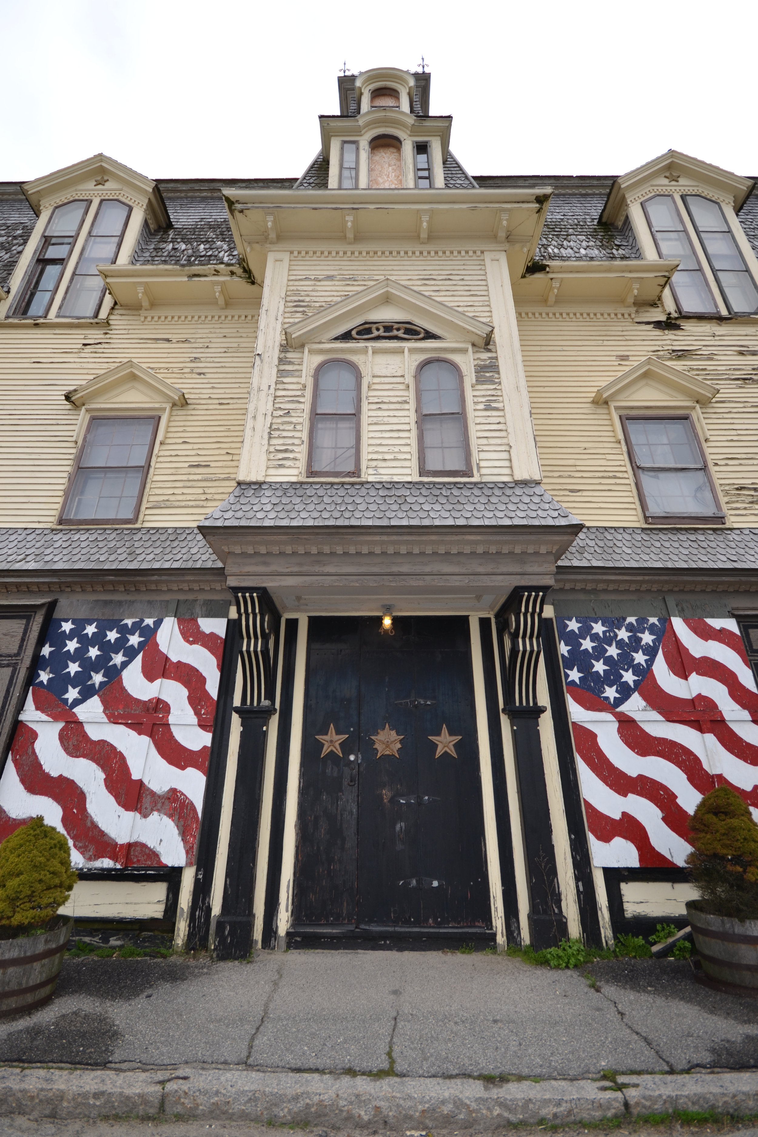
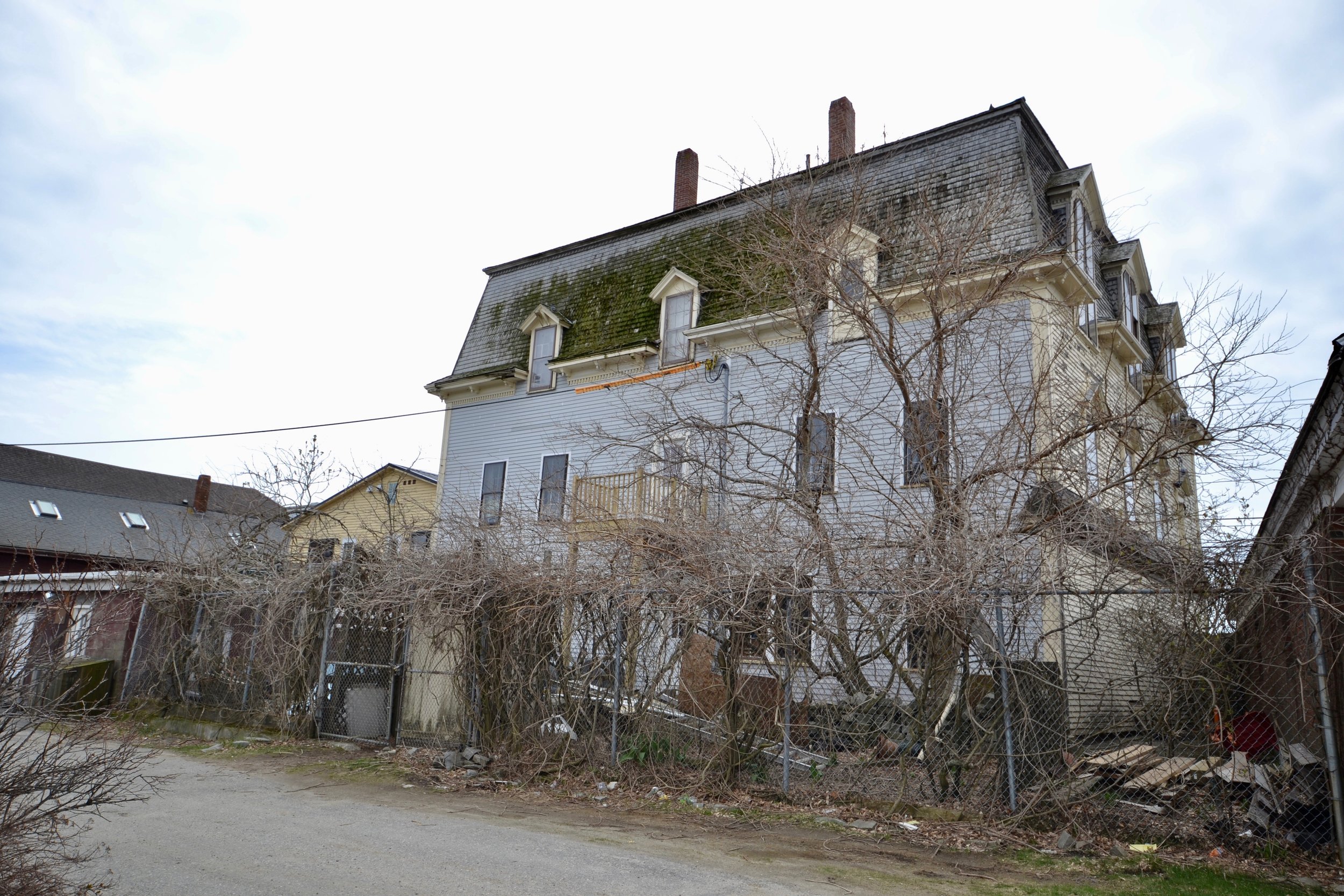
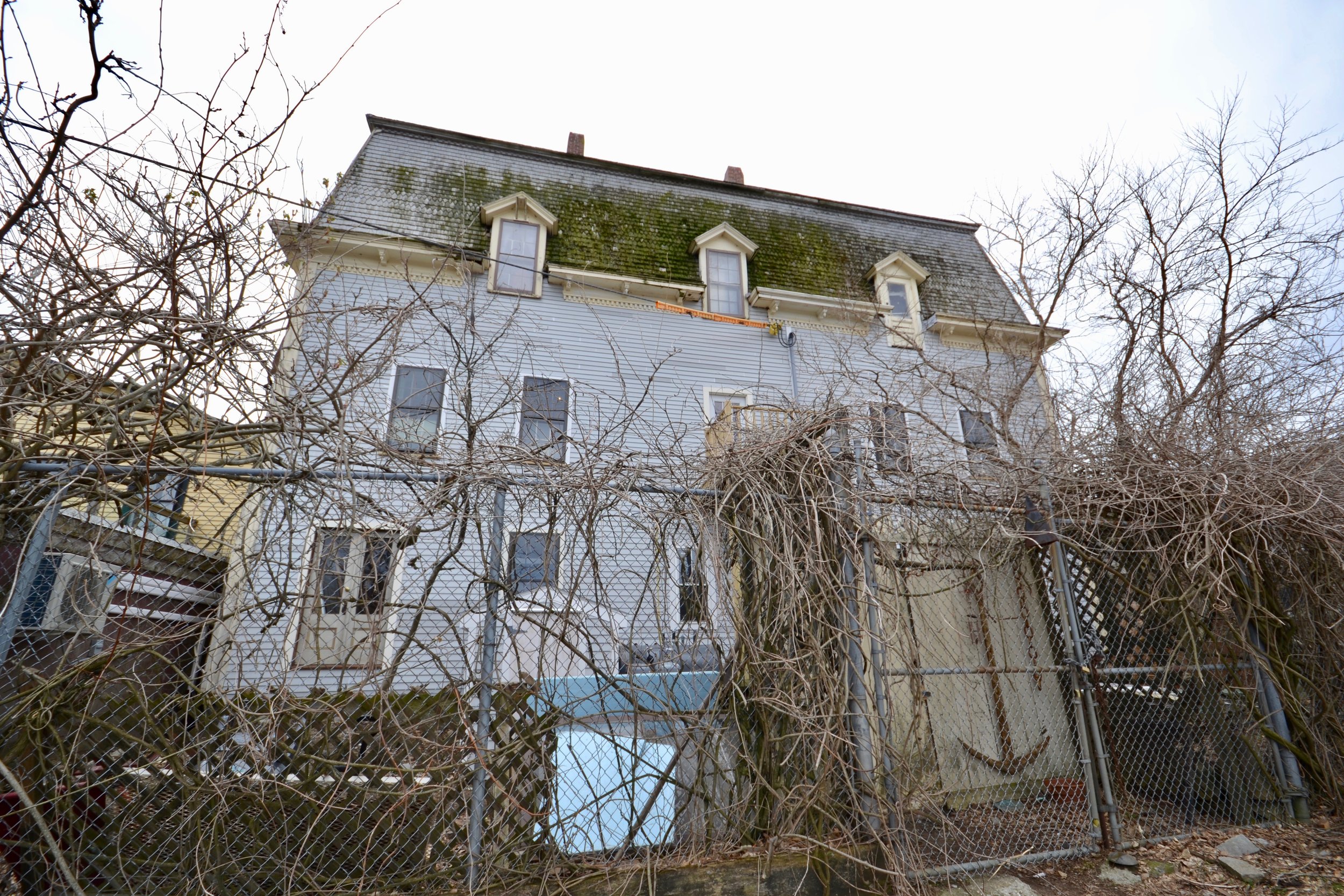
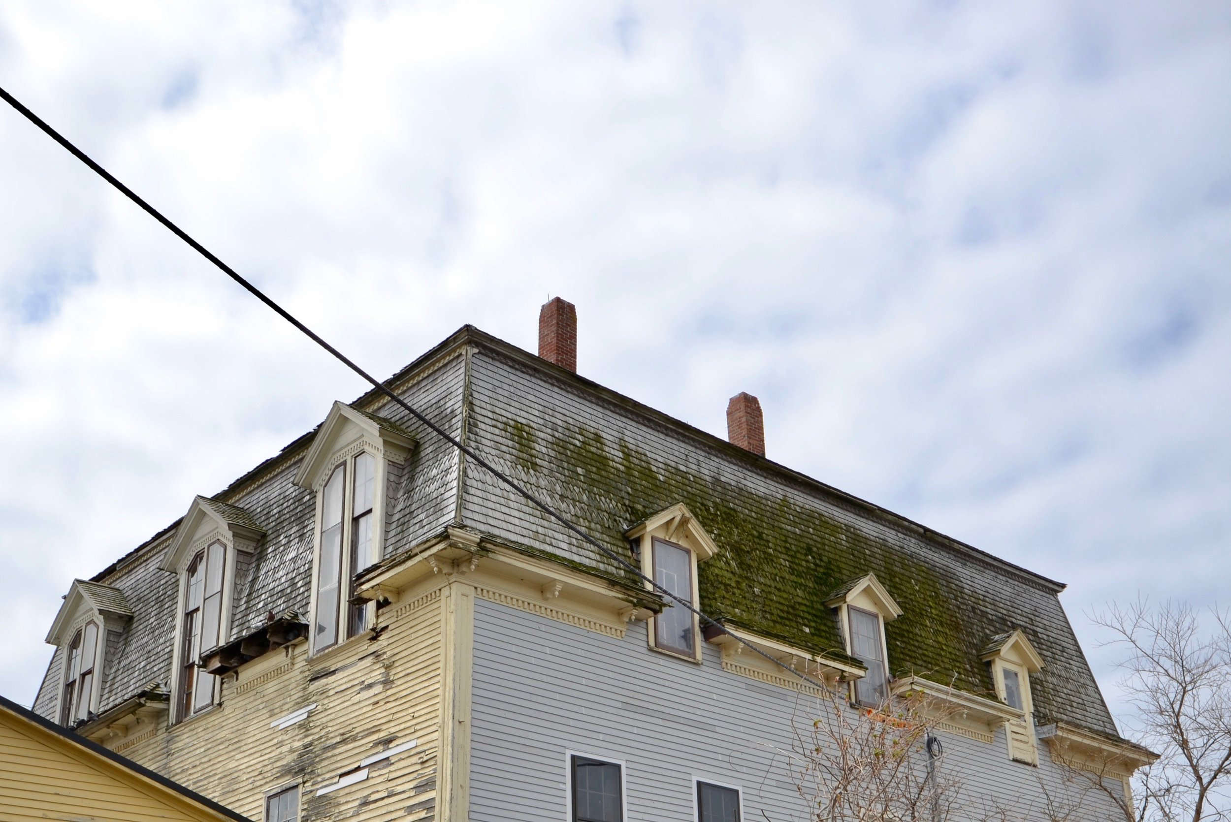
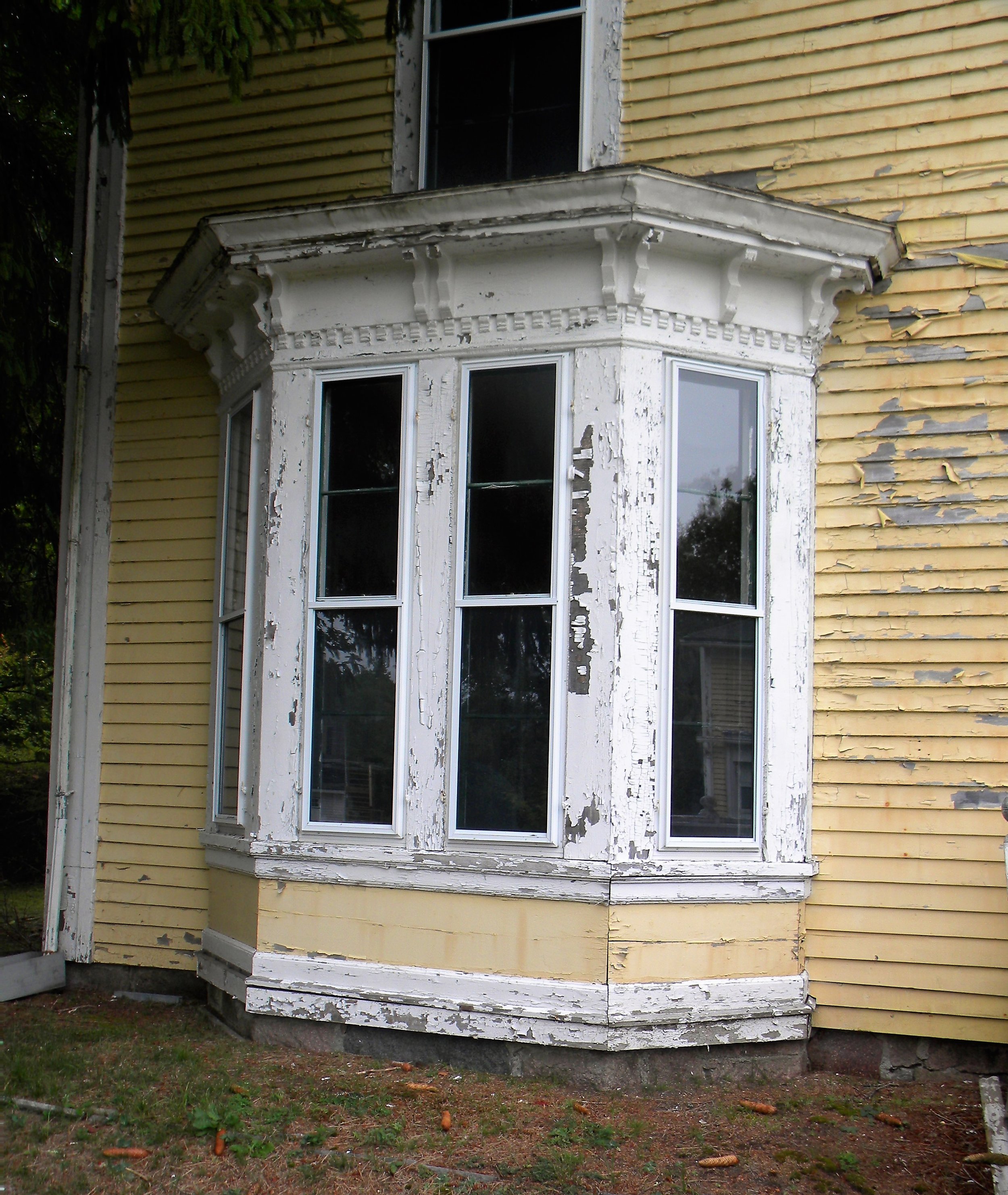
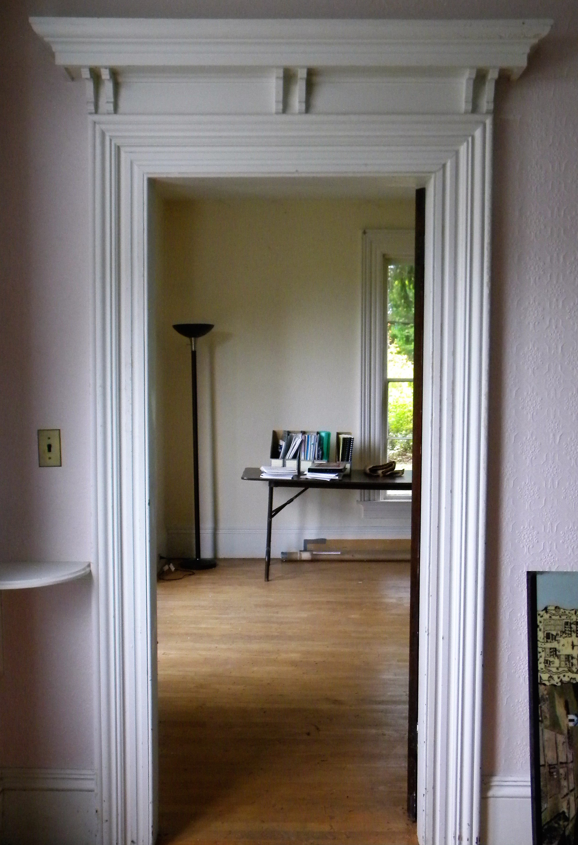
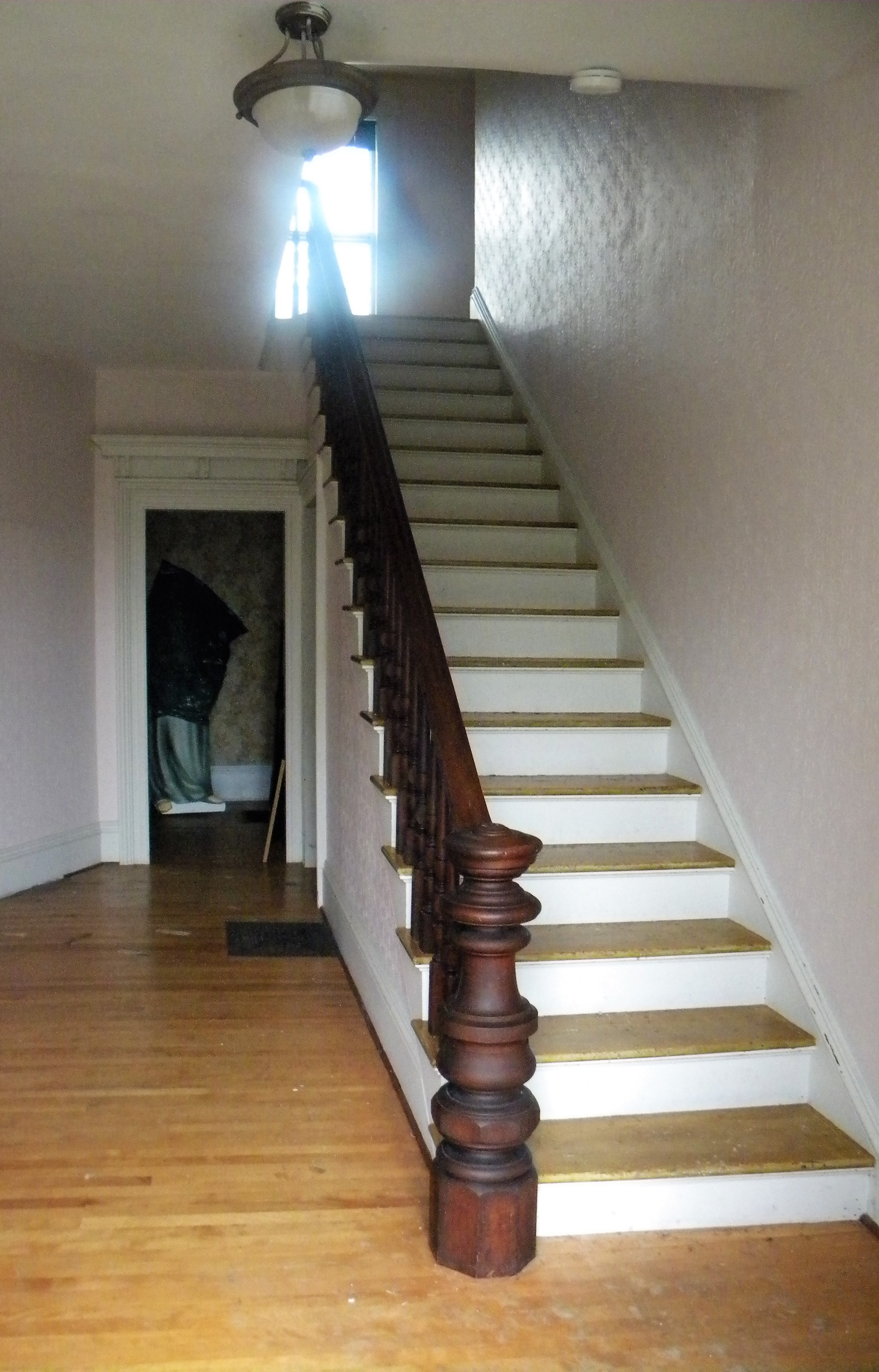
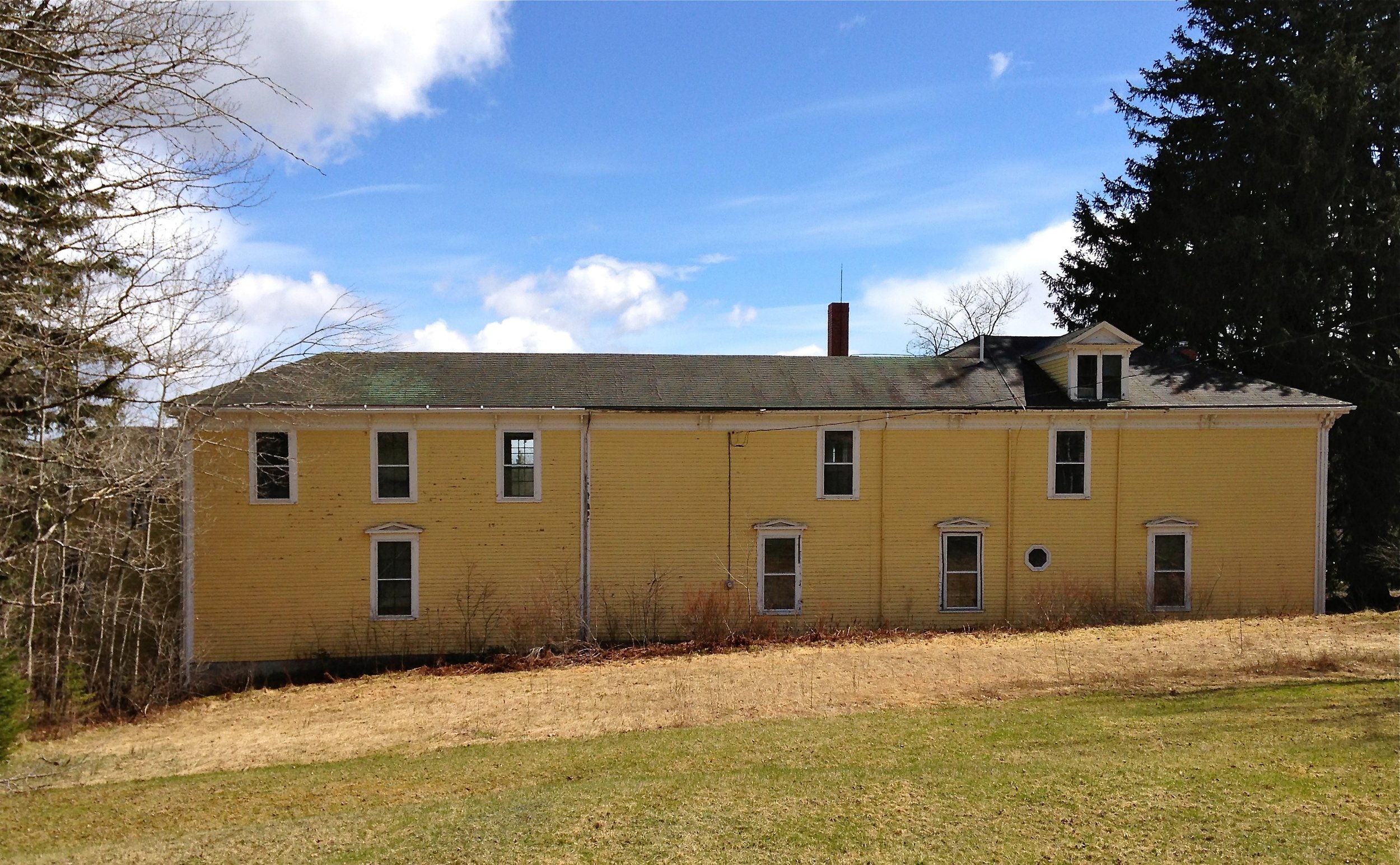
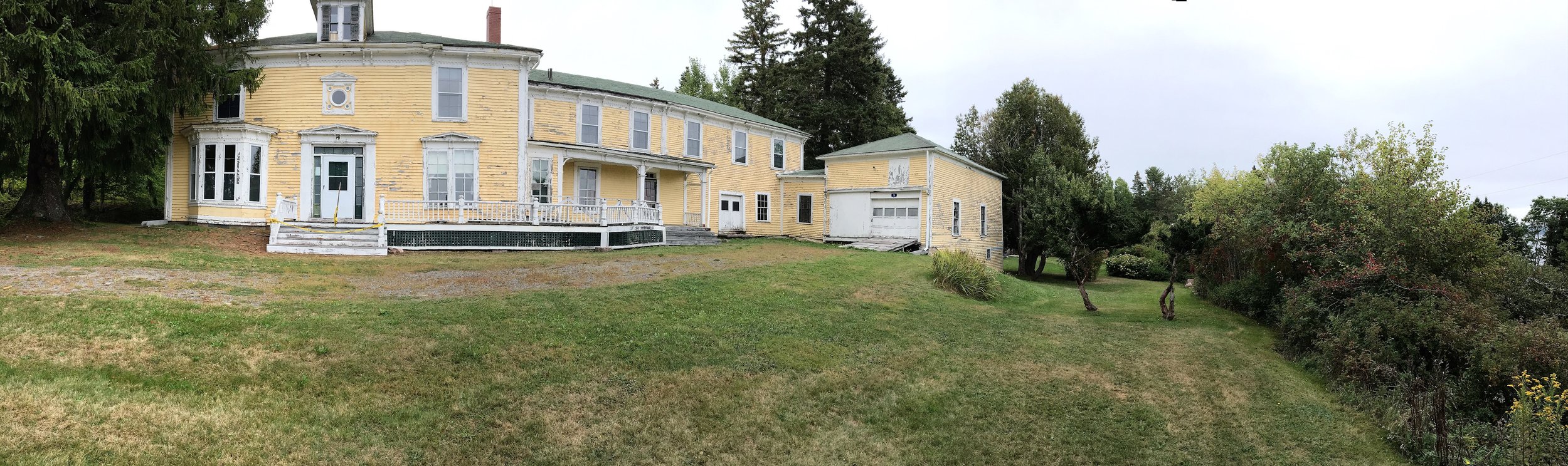
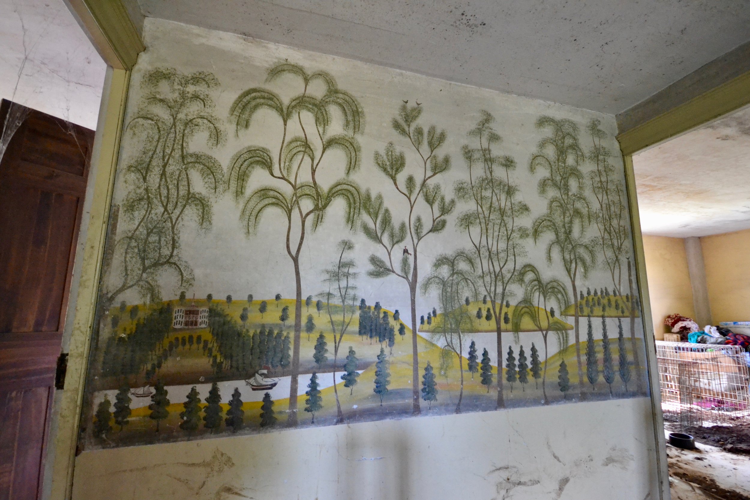
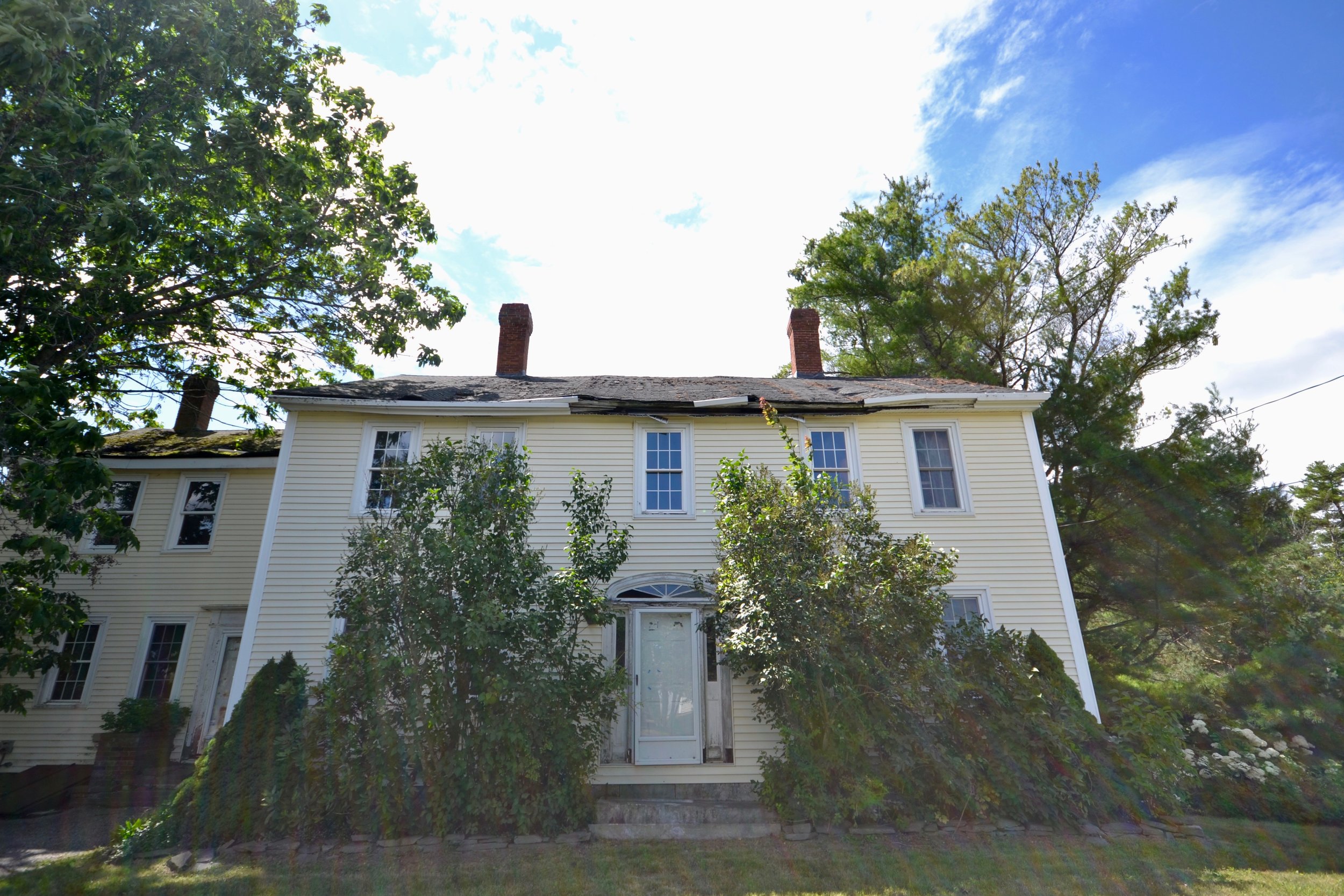
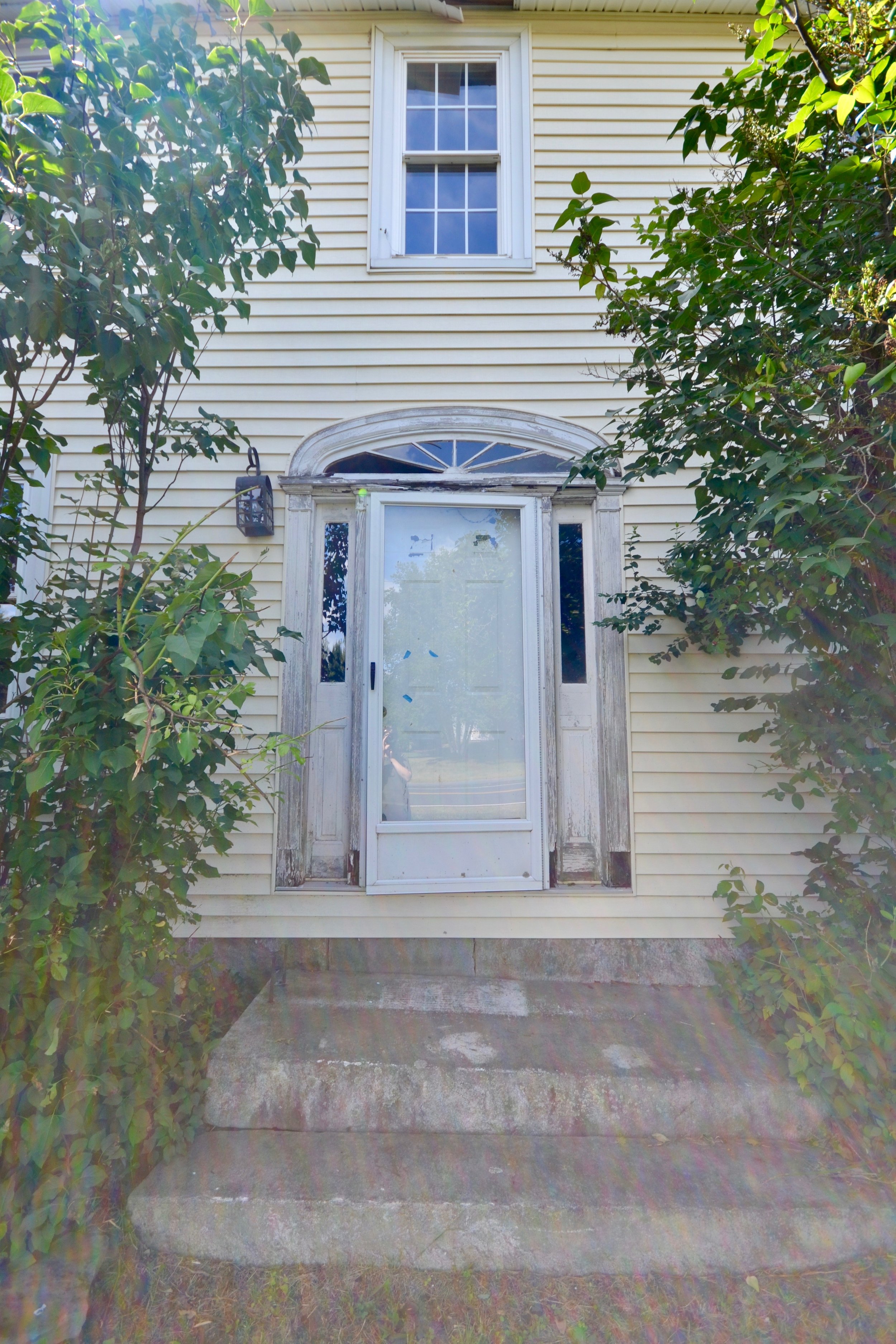
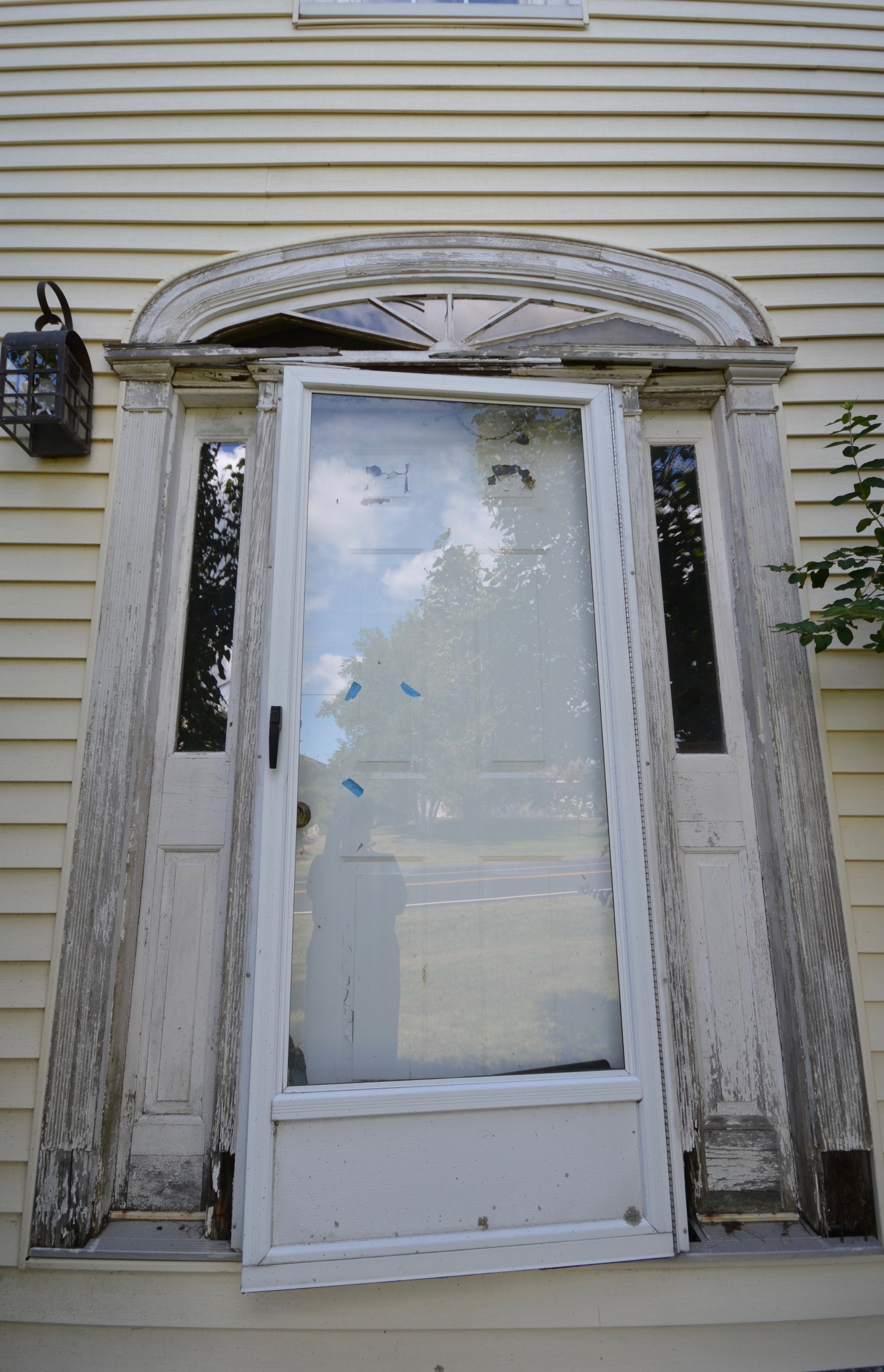
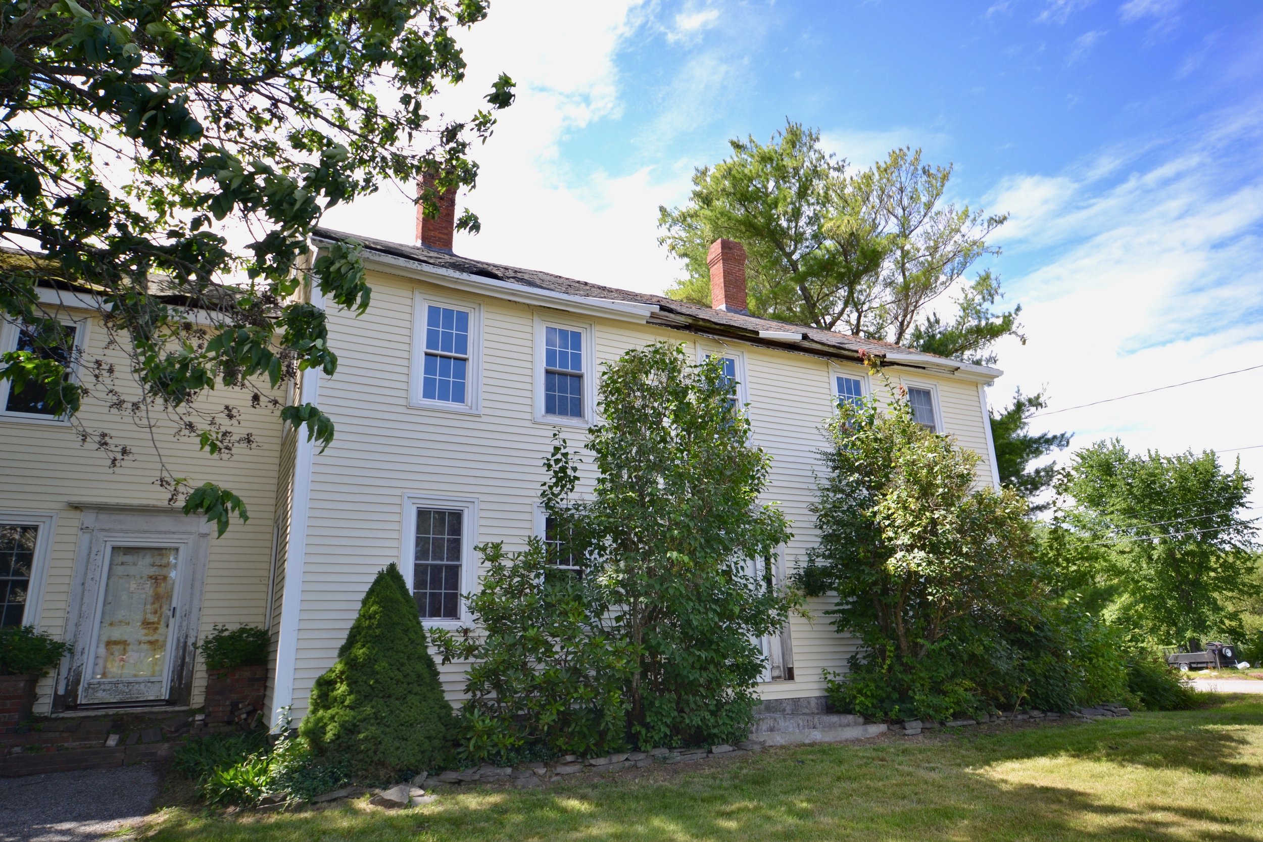
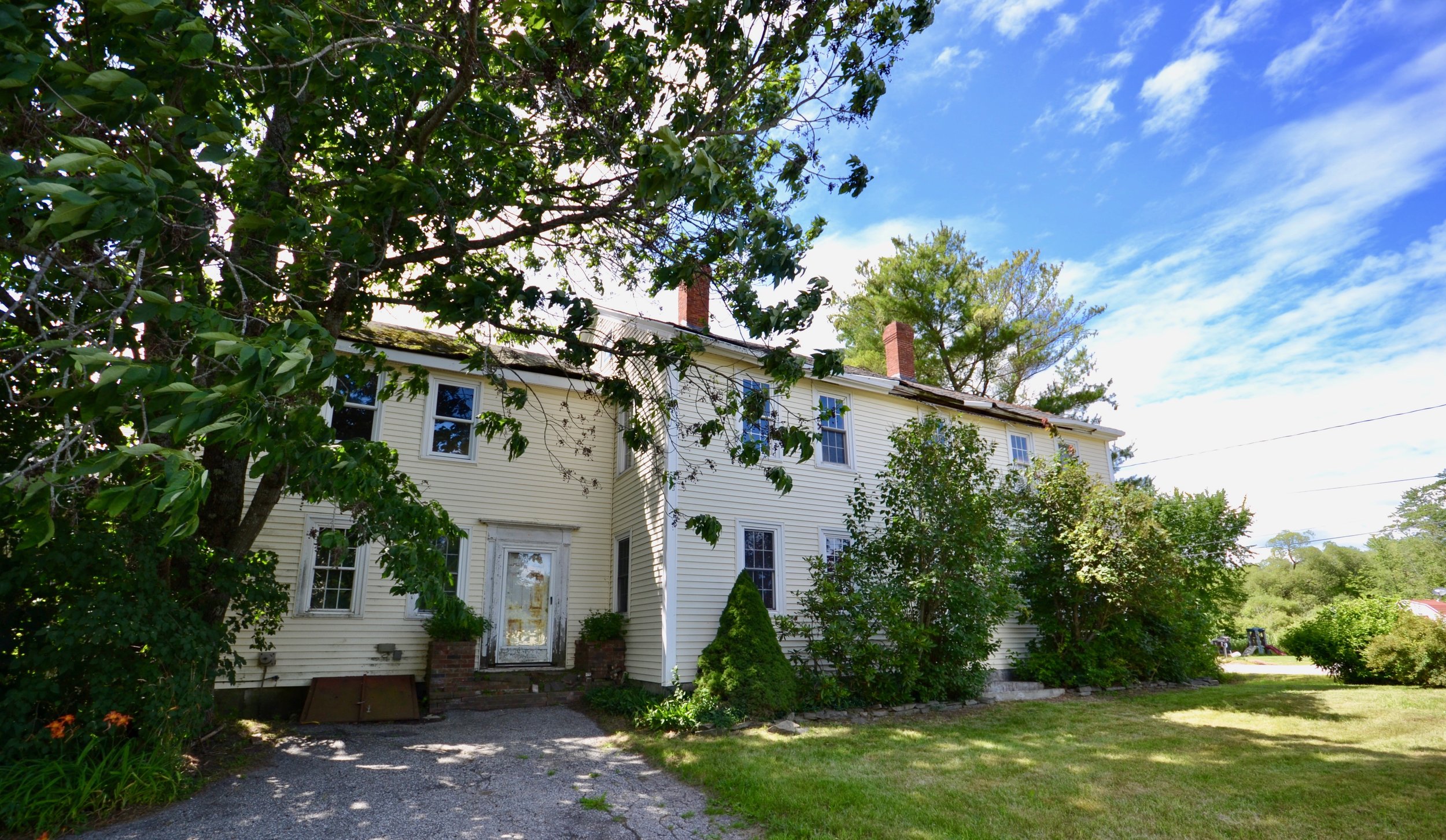
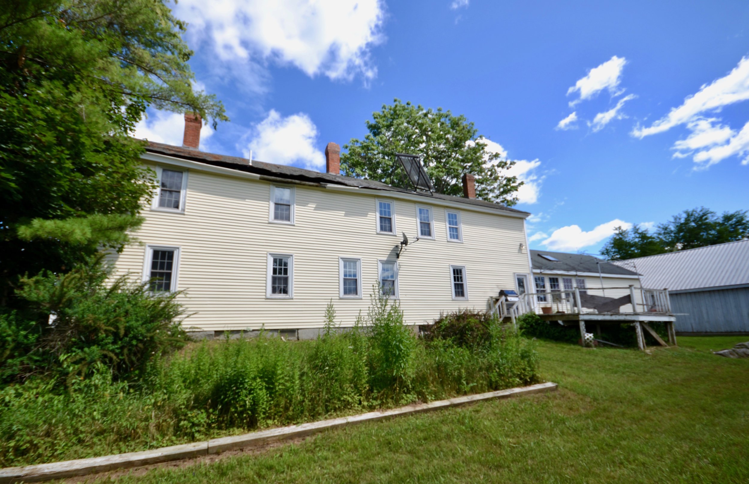
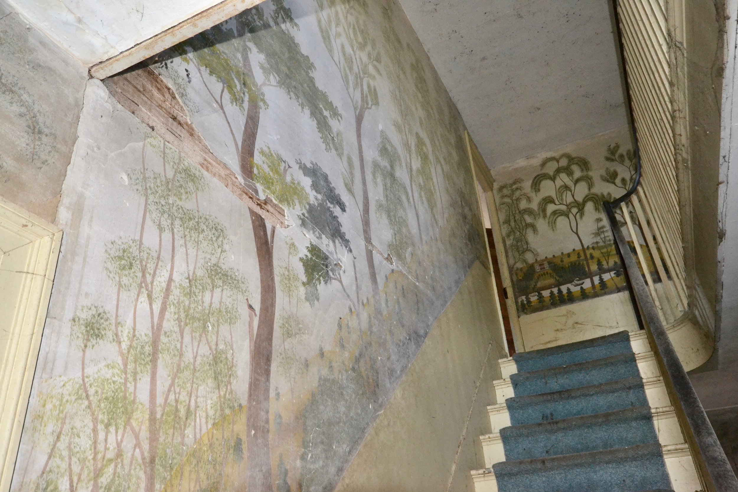
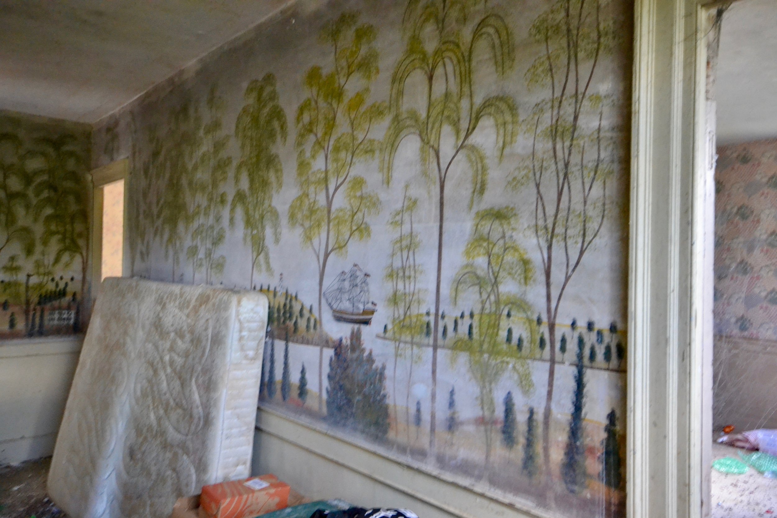
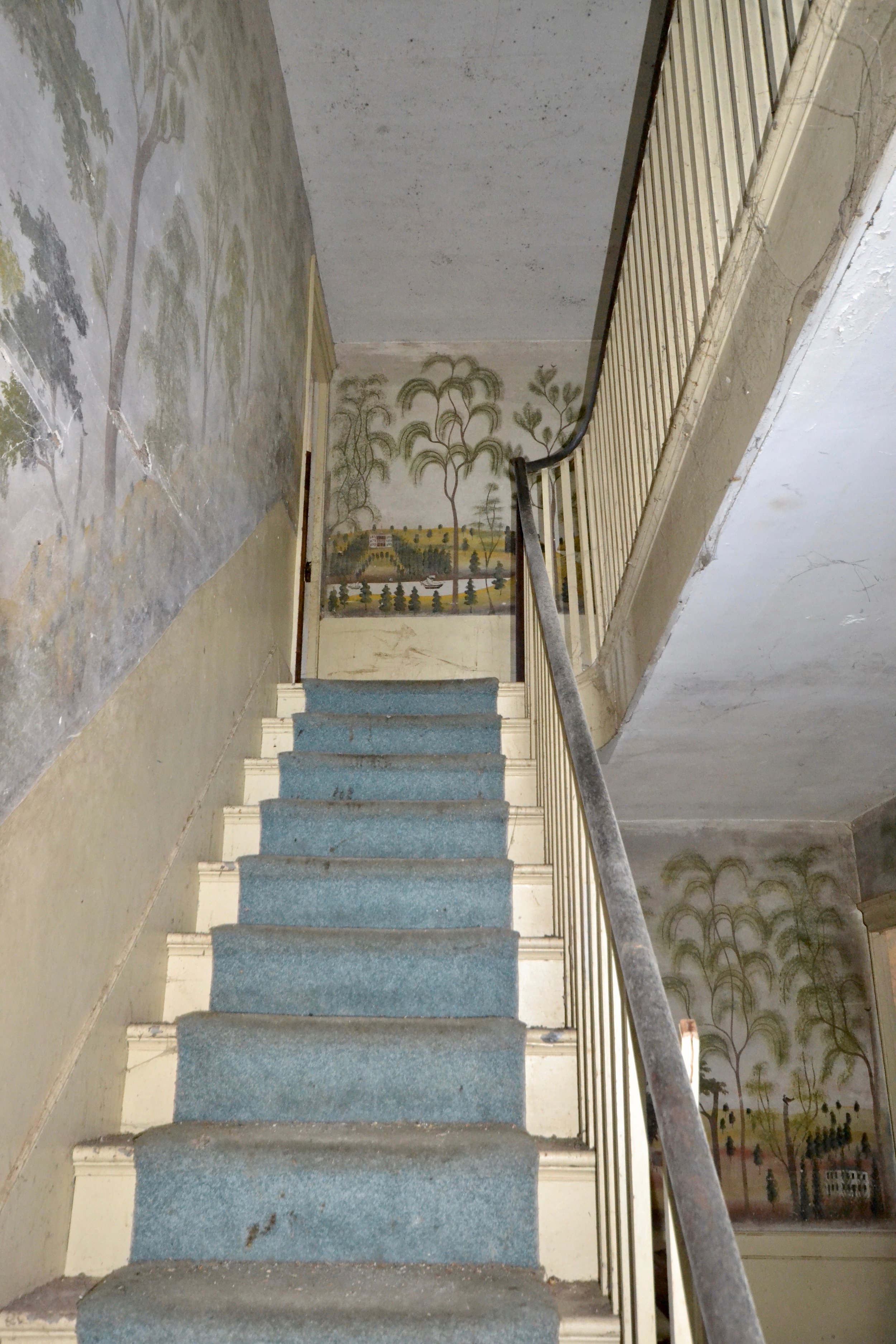
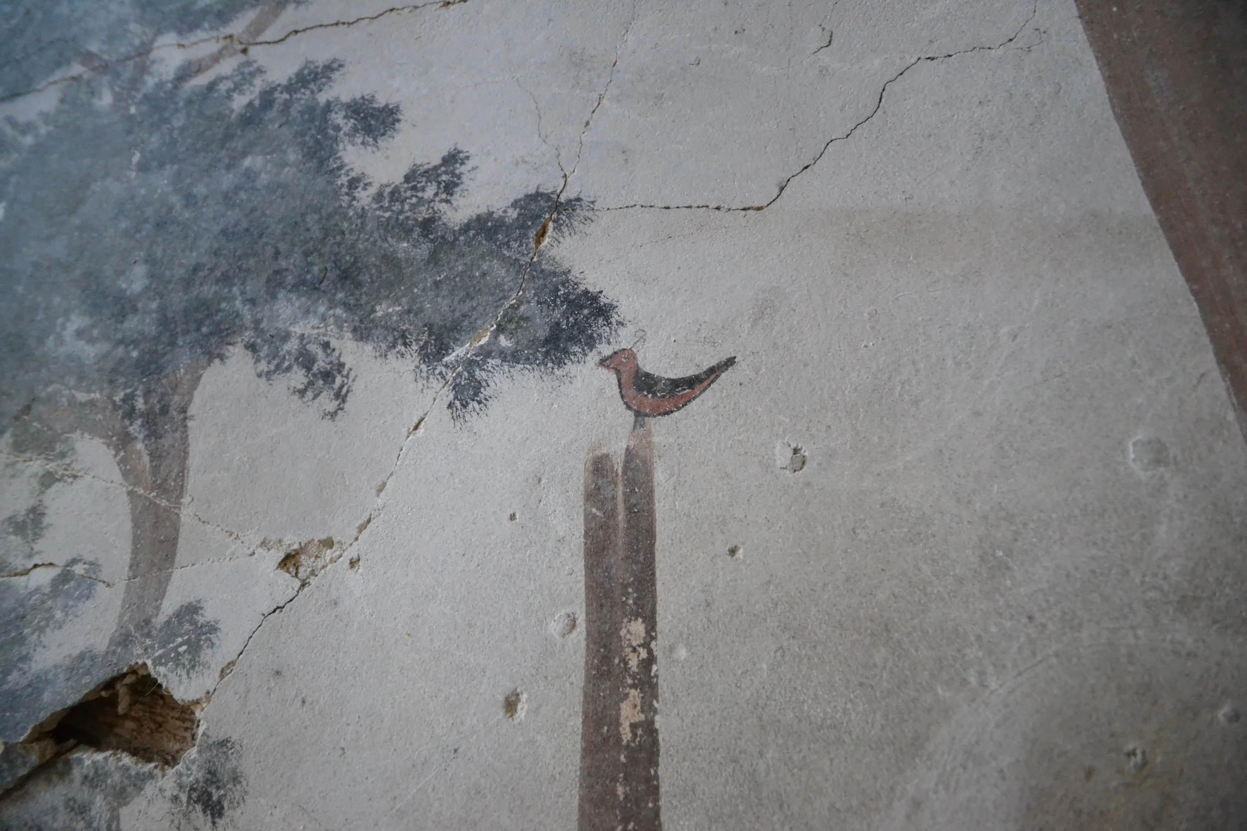
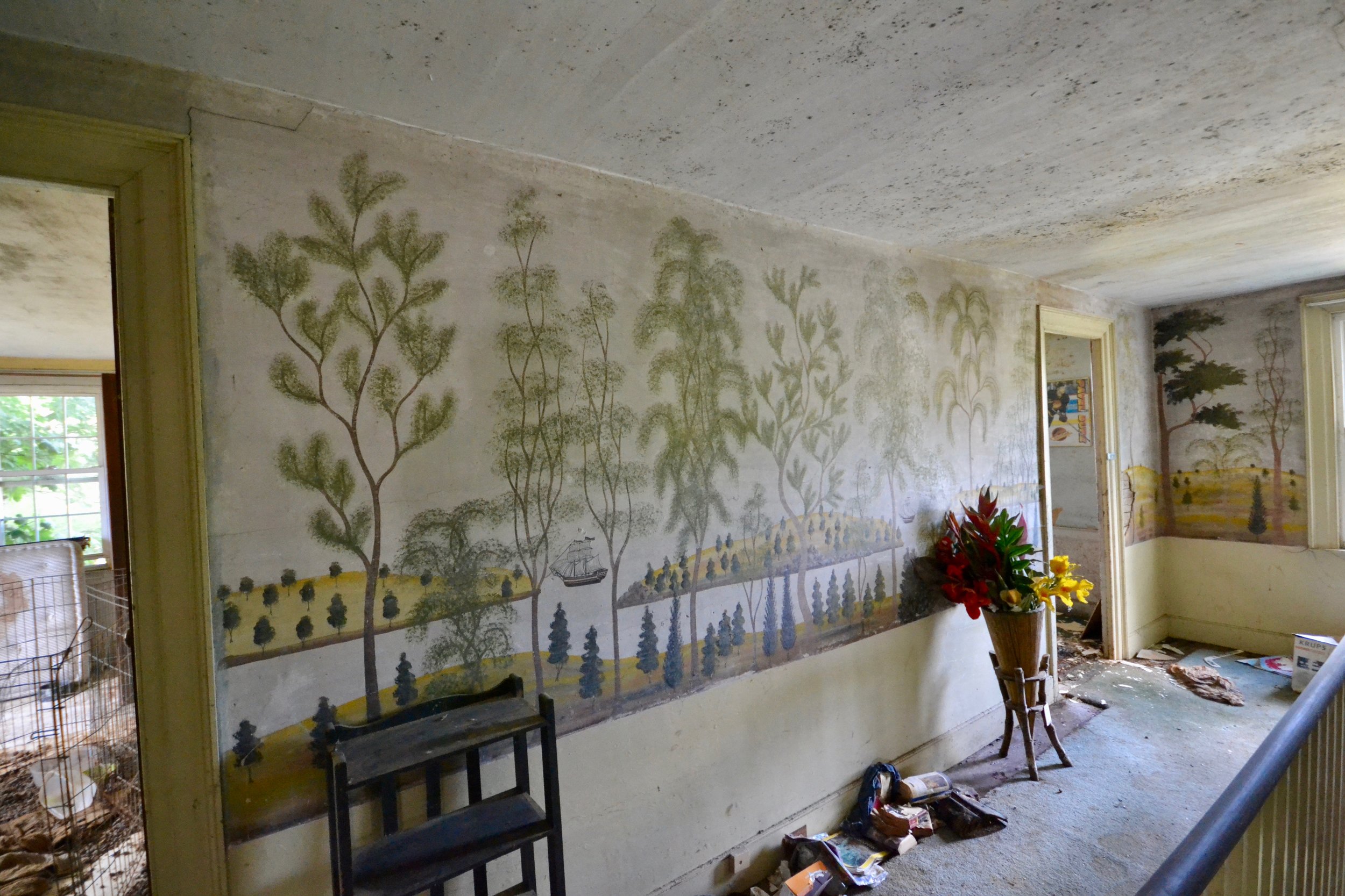
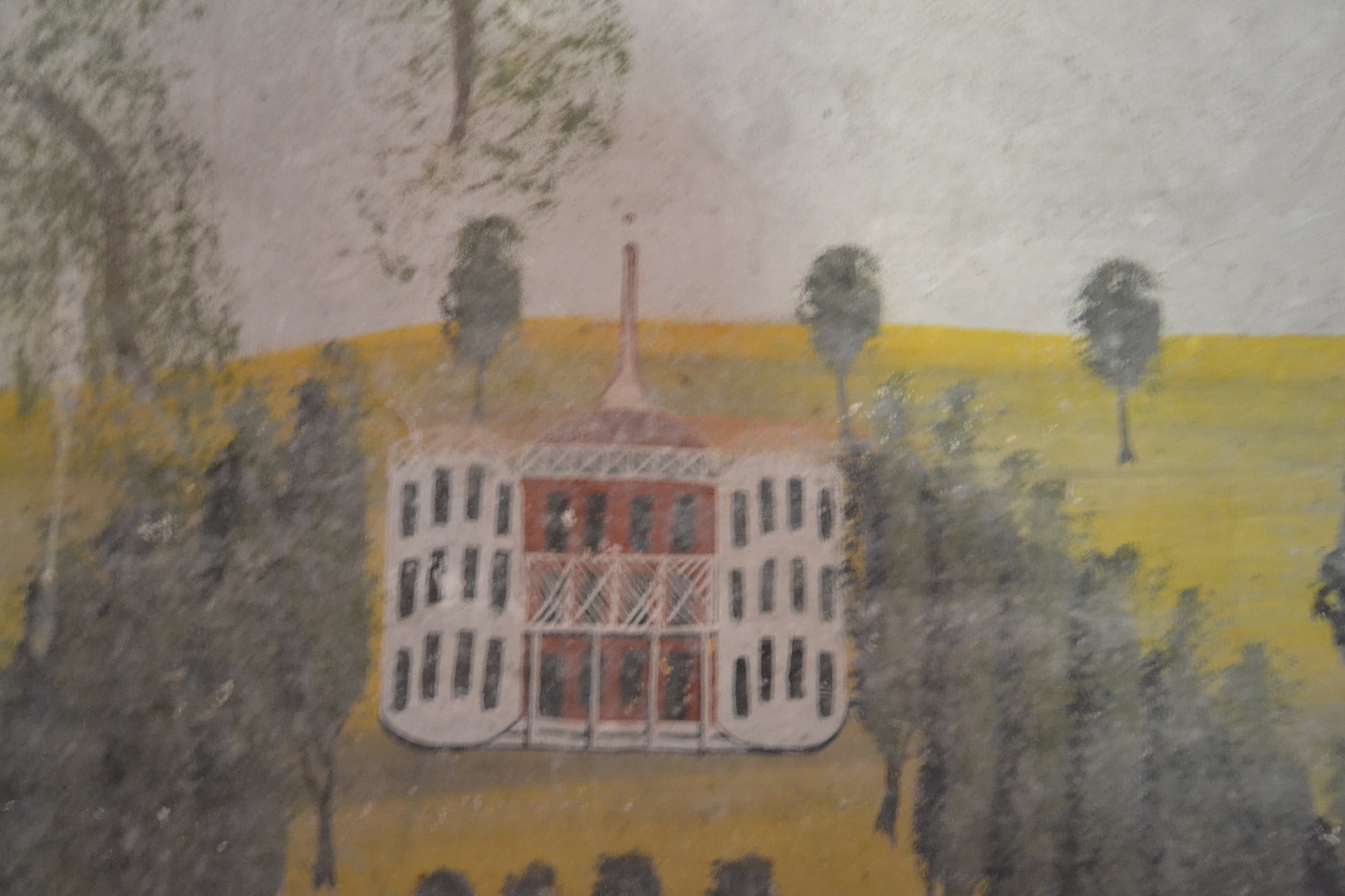
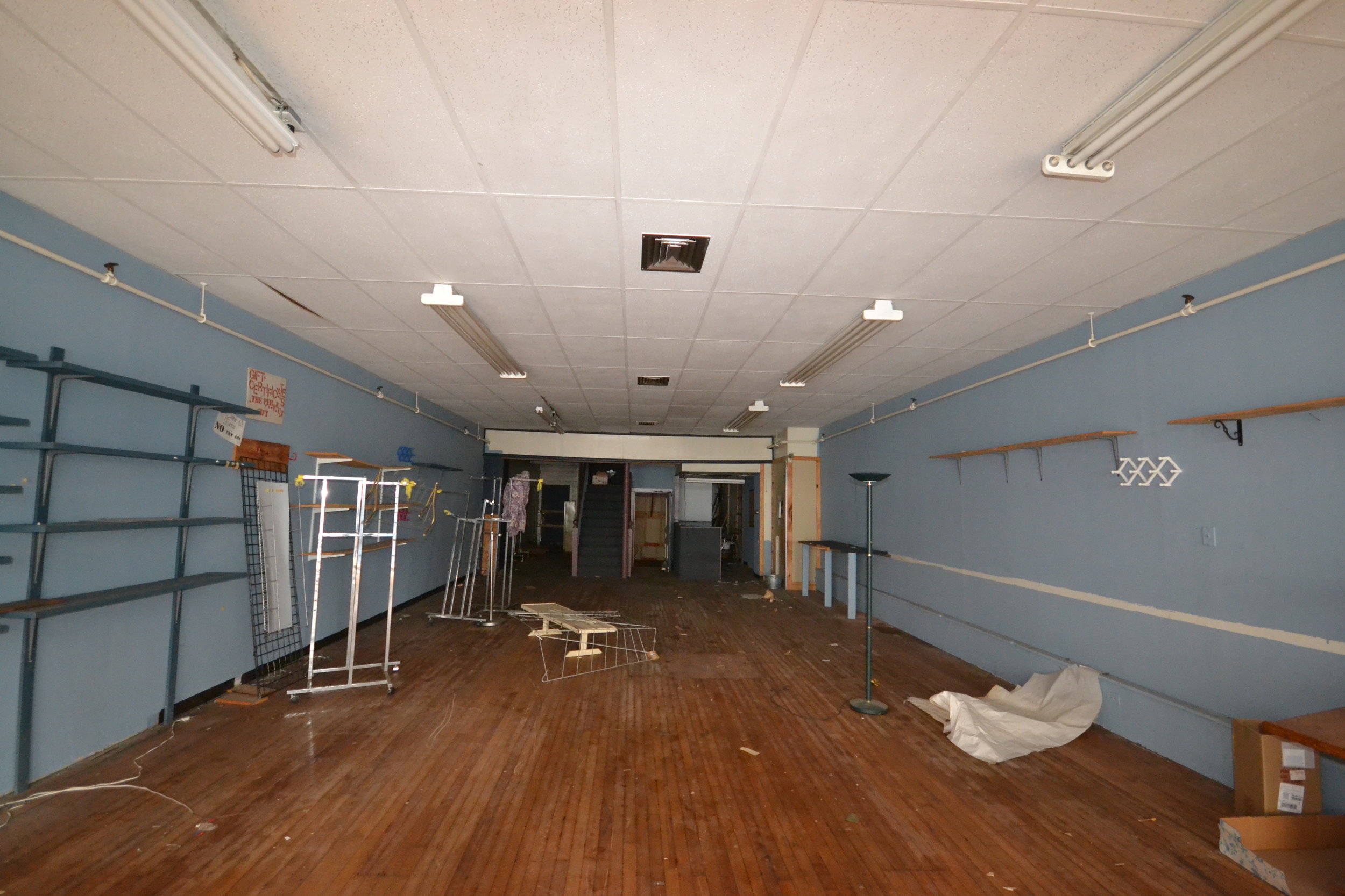
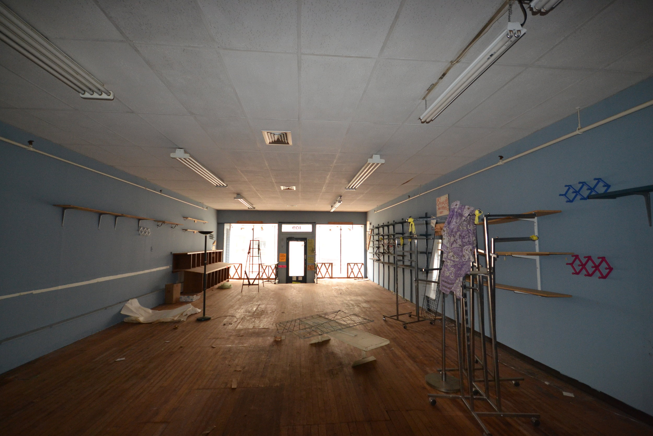
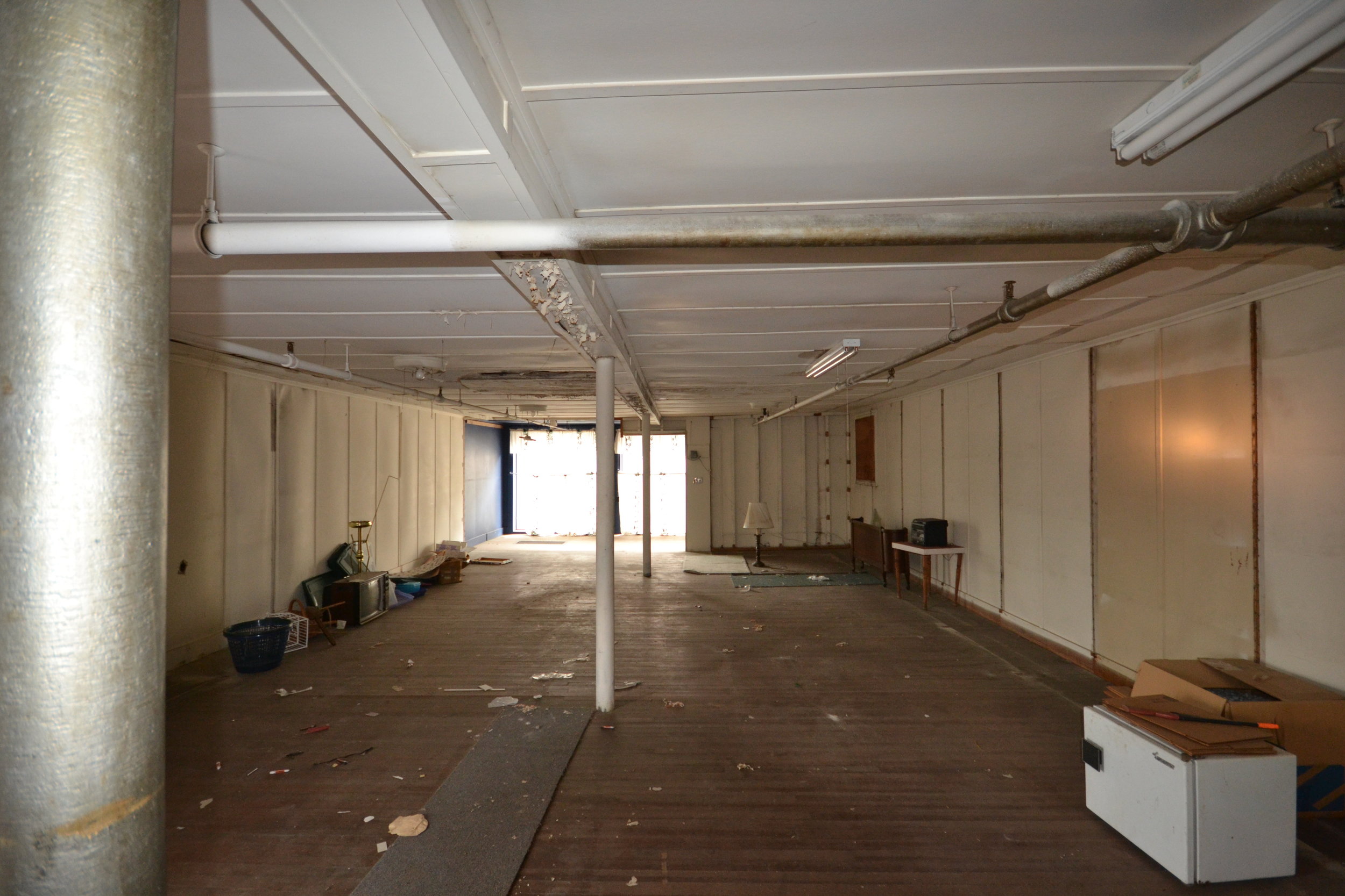
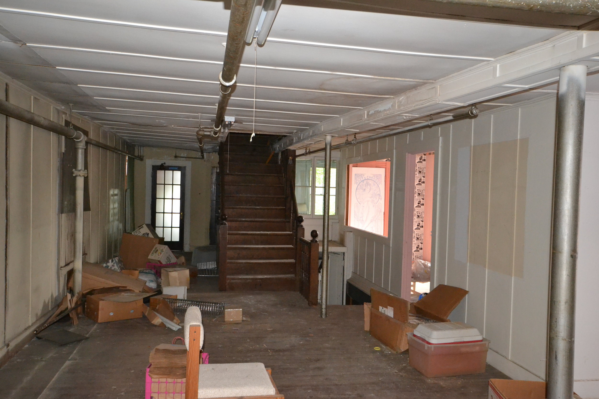
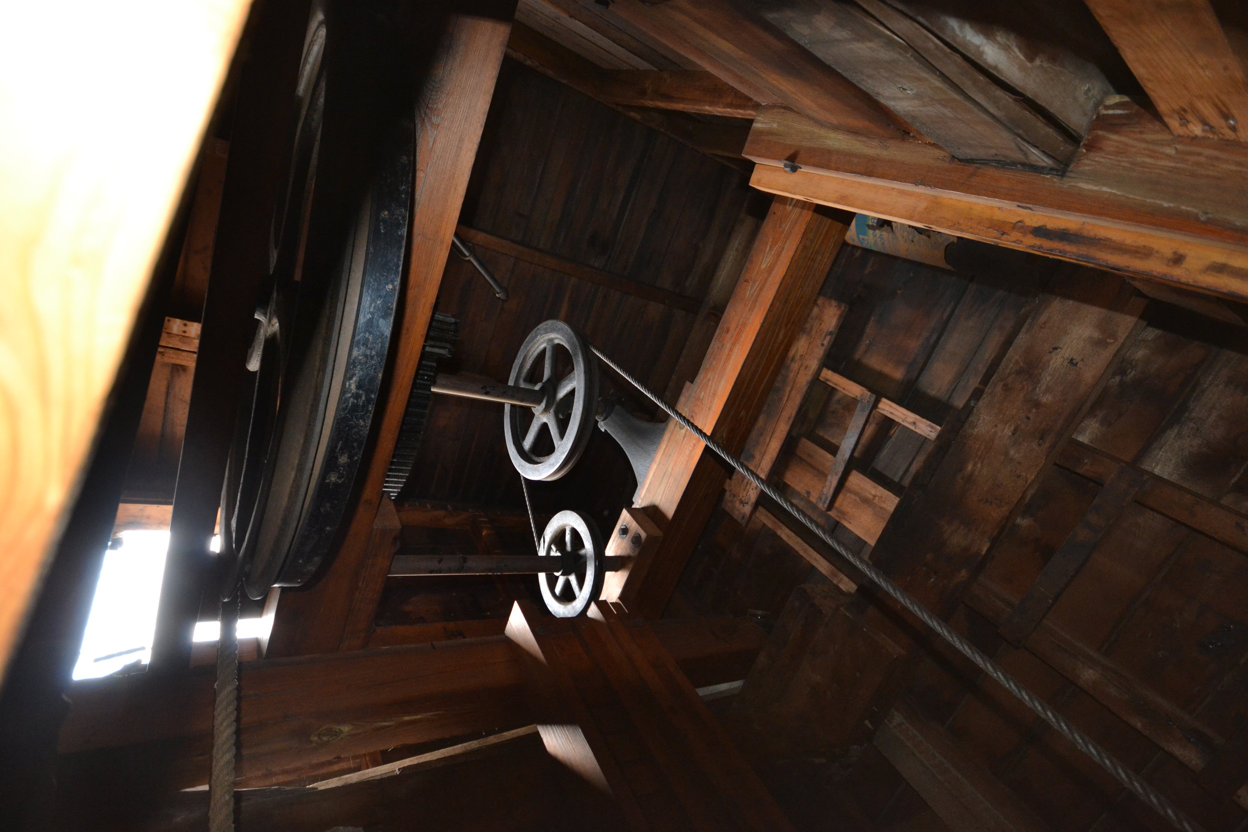
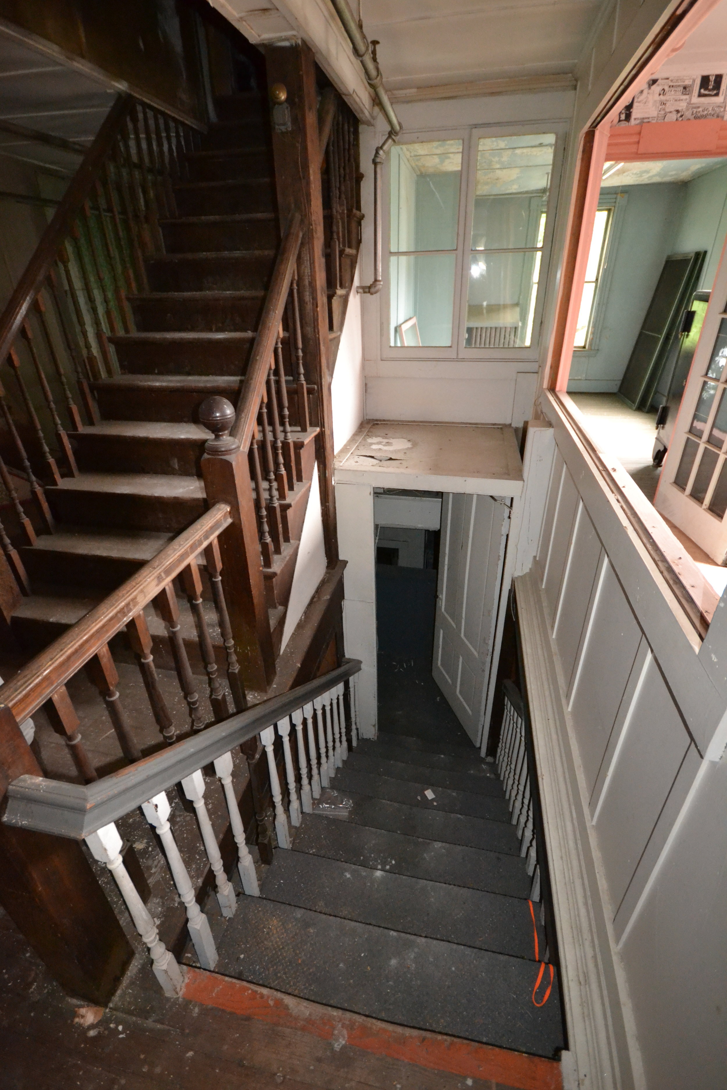
The house offers approximately 5,400 SF in the main house and 750 SF in the barn. It features three bedrooms on the second floor of the main block and a number of others in the ell. The first floor features a parlor and dining room with pantry off the central hall with Italianate style details including molding, panel doors and two tiled fire places. A hall extends to the kitchen through which is the woodshed. The ell extends to the carriage barn which features a large sliding door, a second story loading door, and three horse stalls. The basement is unfinished concrete floor with a cut red granite stone foundation.

TAKE A VIRTUAL TOUR!

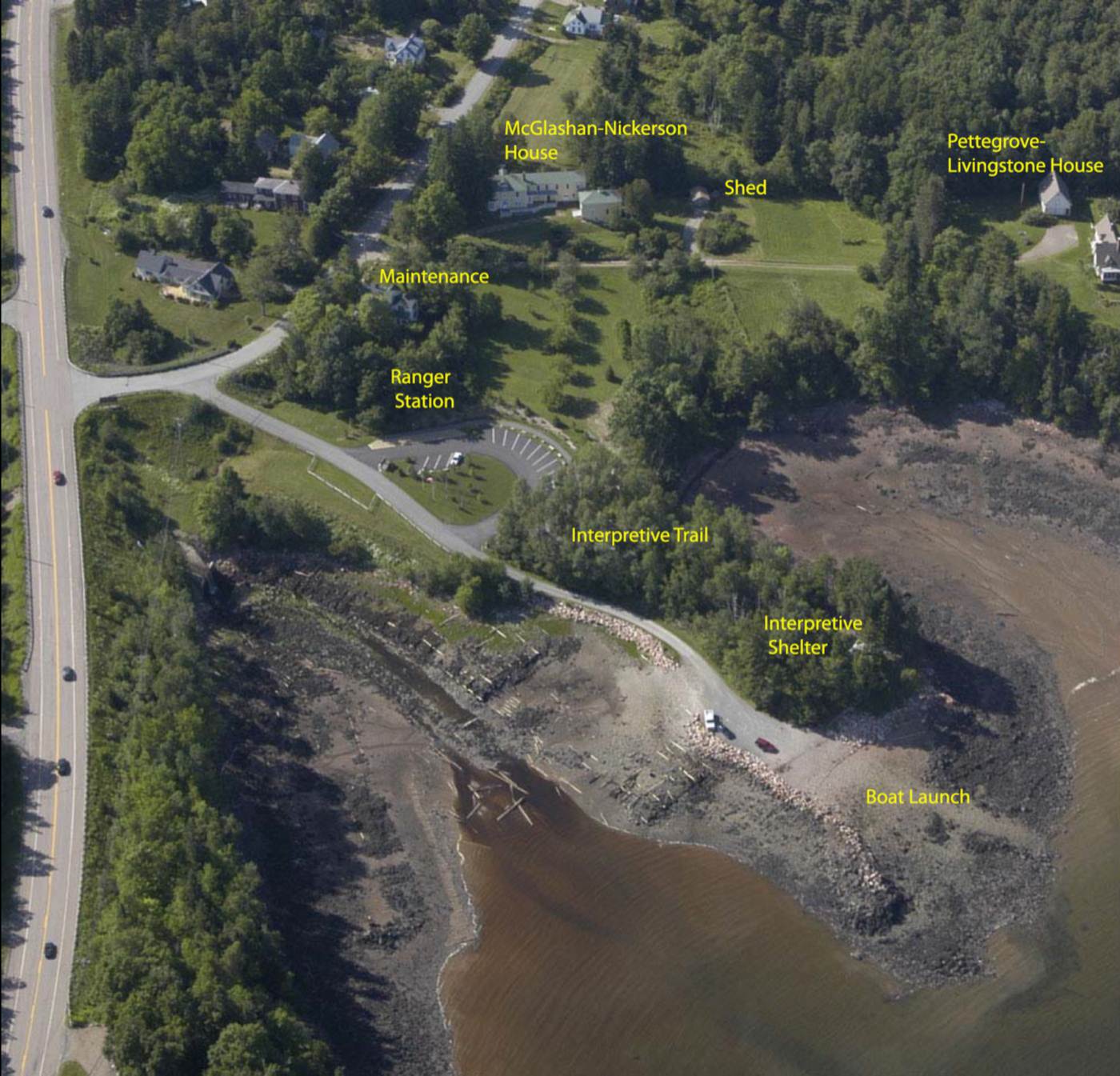
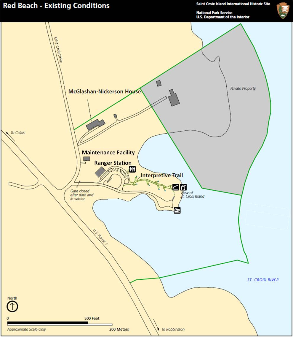
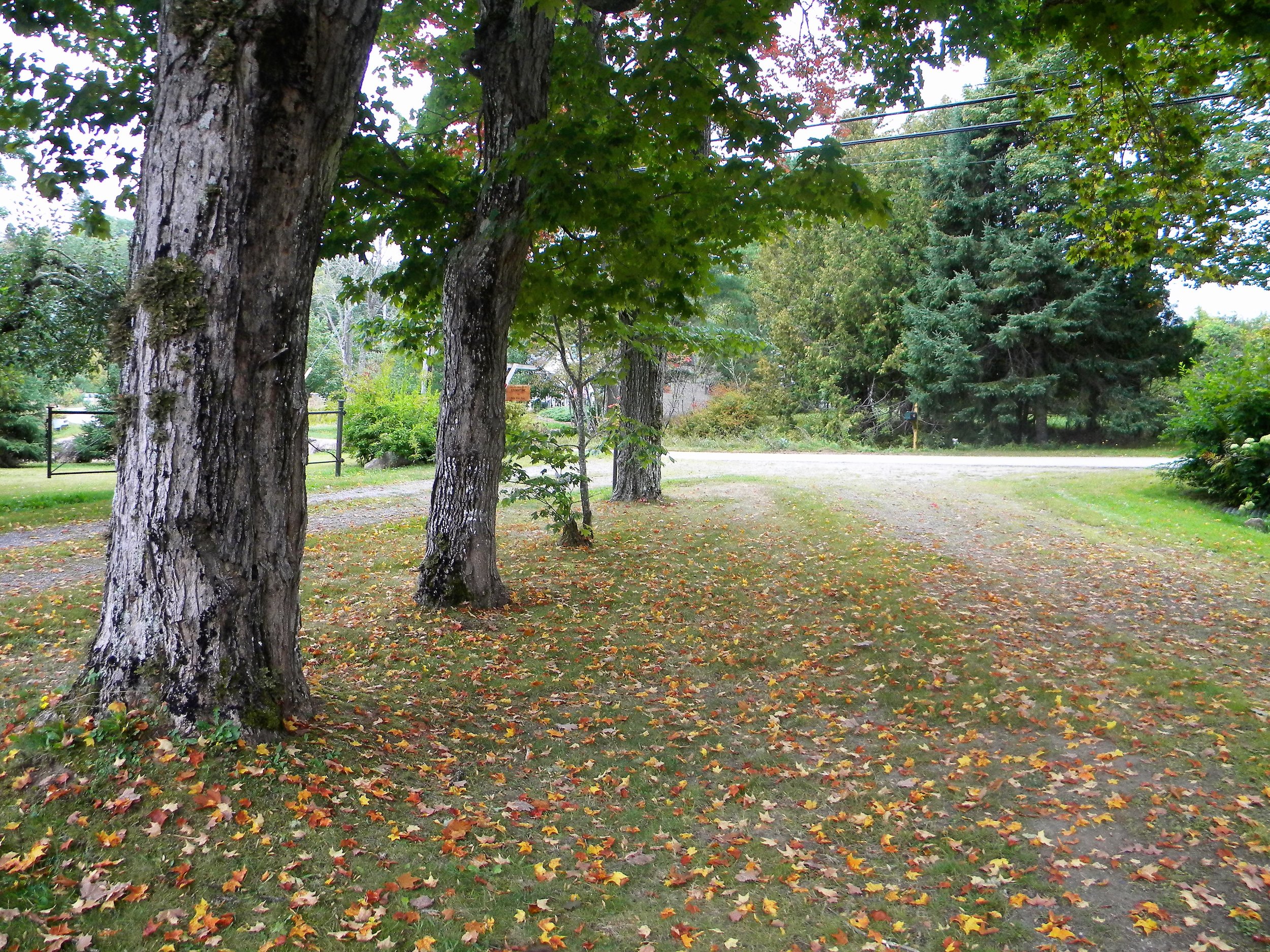
The boundary of the Lease Premises includes approximately 1.5 acres which is a portion of land historically associated with the property. The boundary includes the house, barn, shed, gravel access and parking area, and an entrance drive which is a shared access to the neighboring property; a Gothic Revival style cottage built in 1854 and is also listed on the National Register of historic Places.

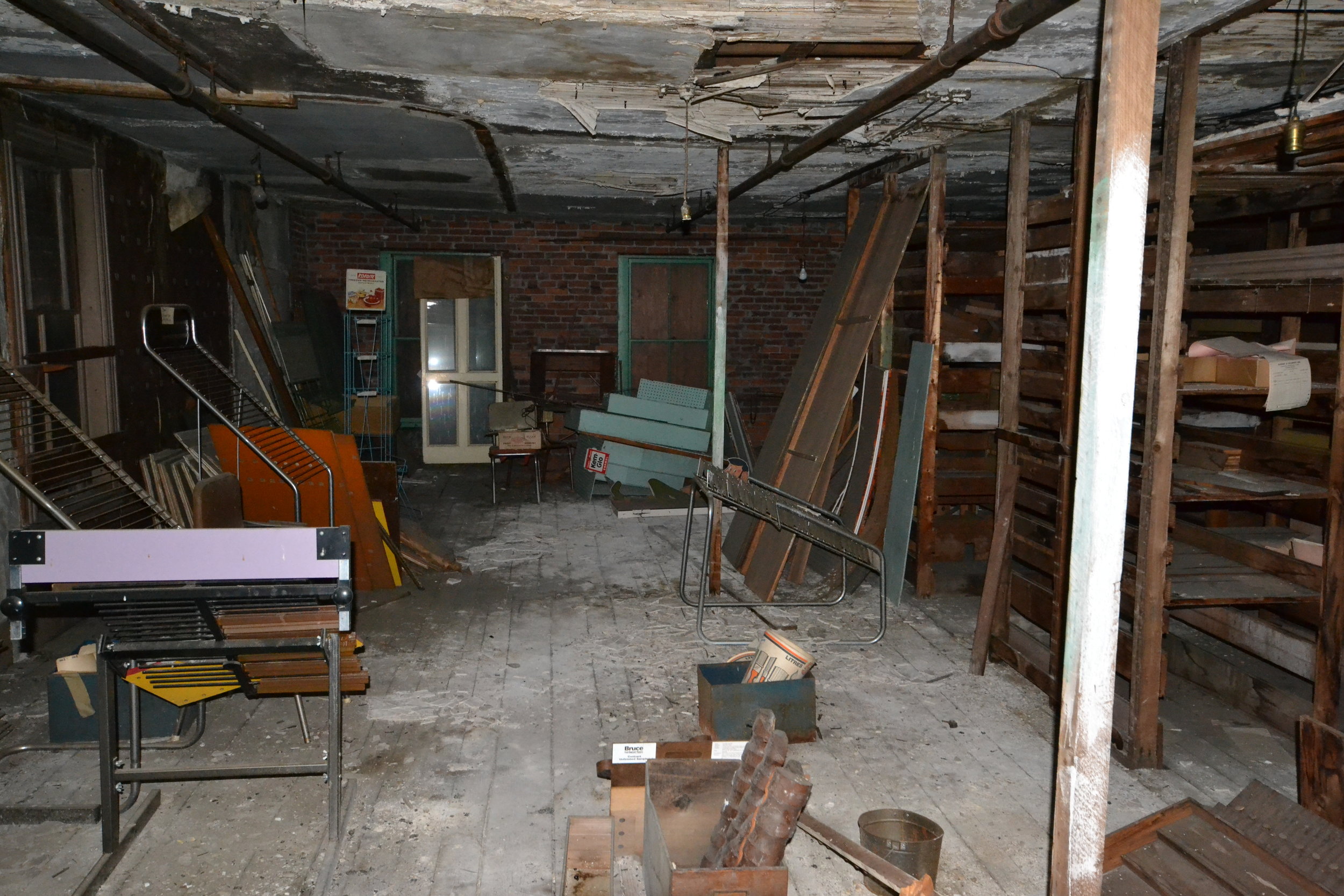
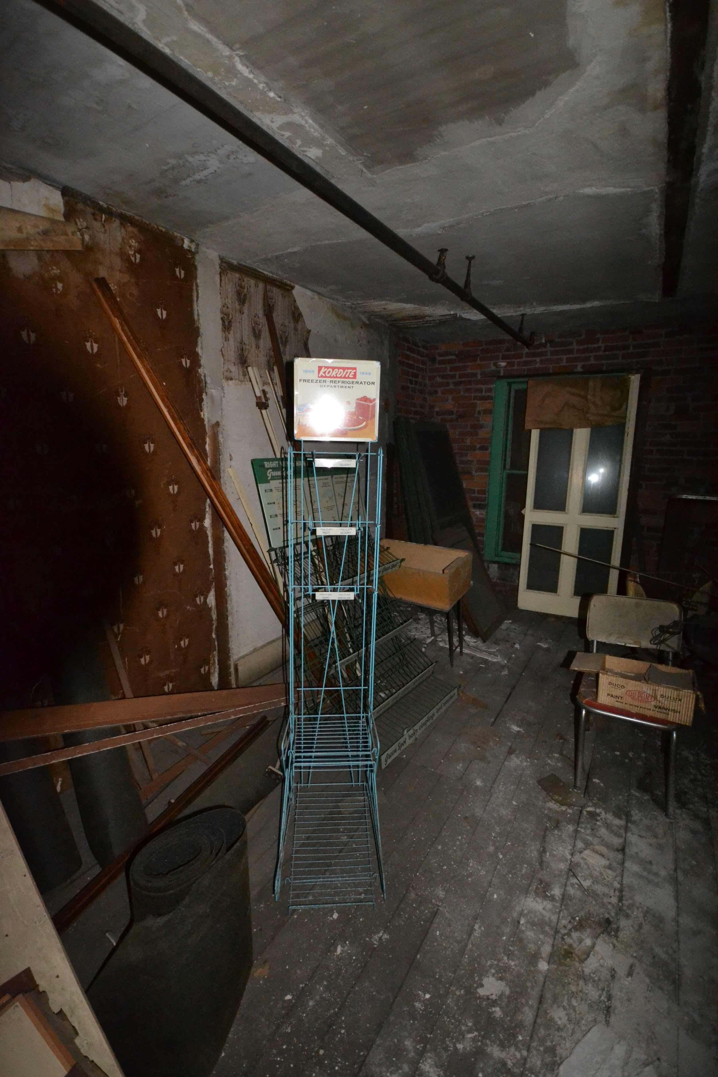
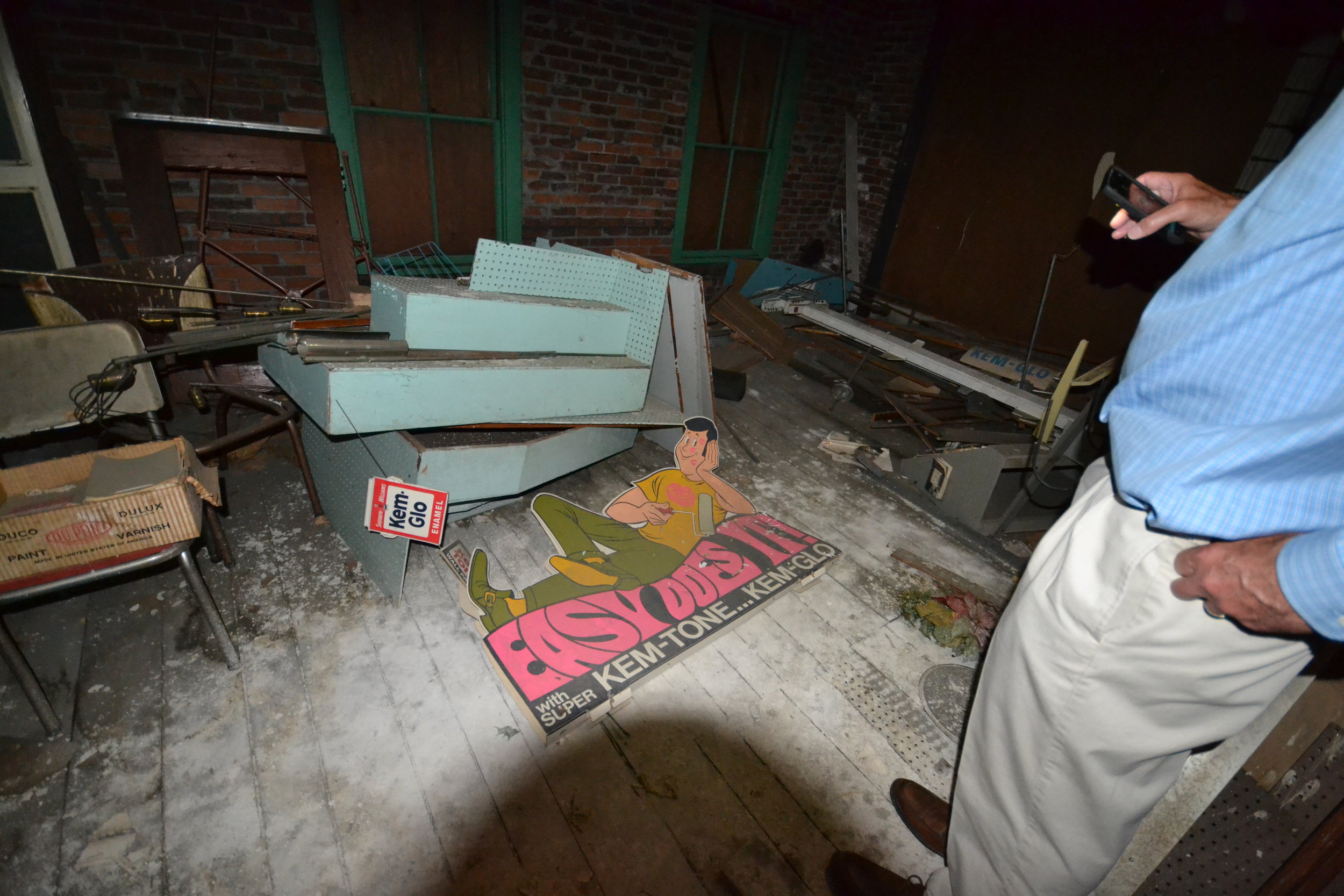
The NPS acquired the property in 2000 to serve as a temporary visitor center, office, and housing until 2014. It has since been used for storage but mostly shuttered.

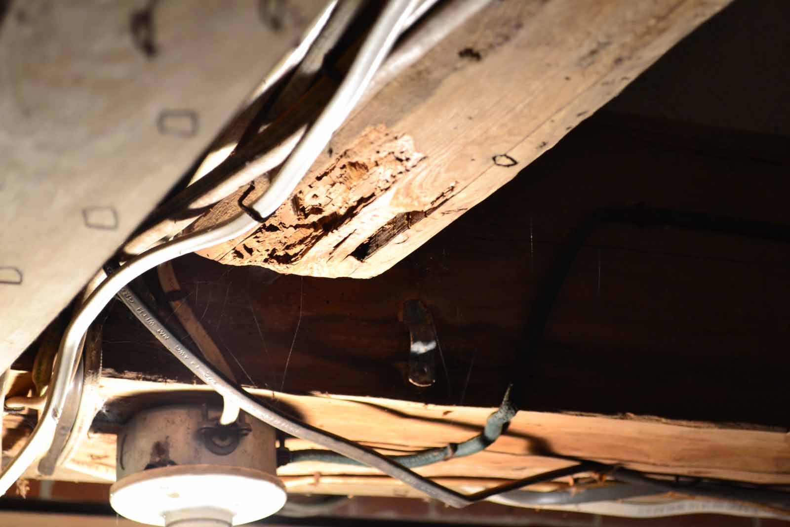
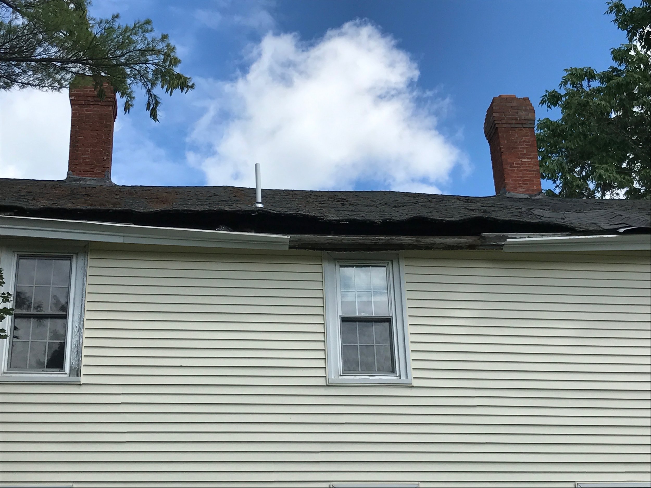
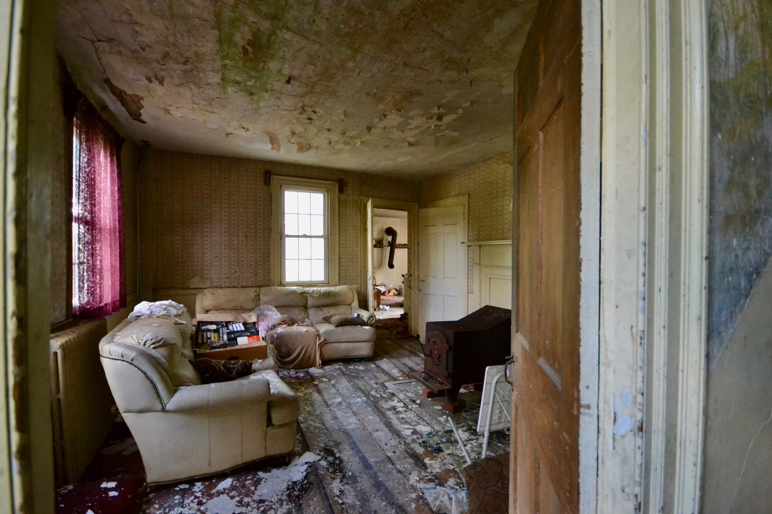
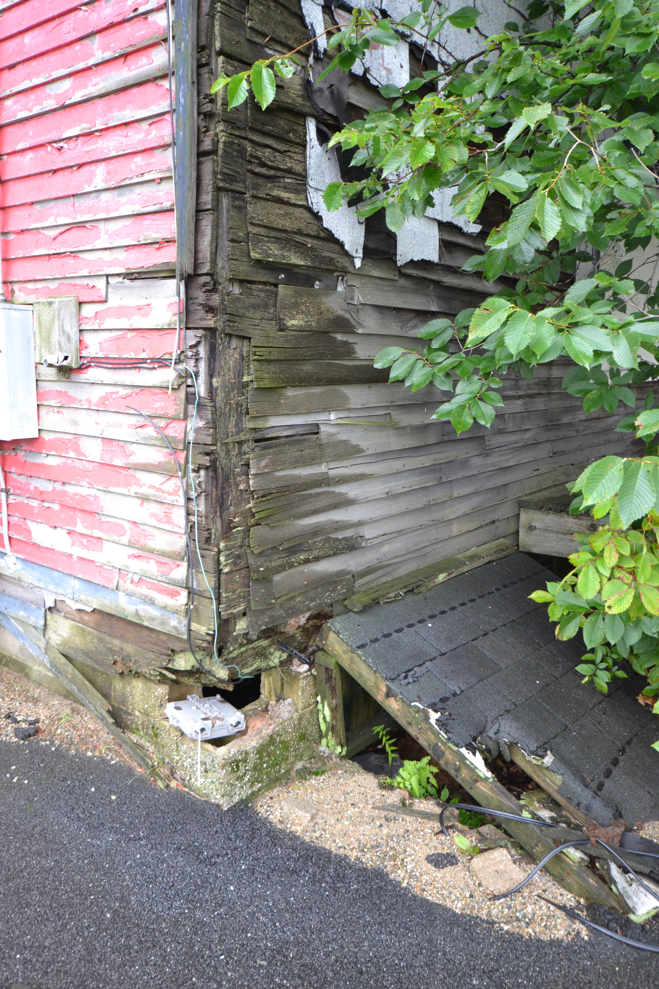
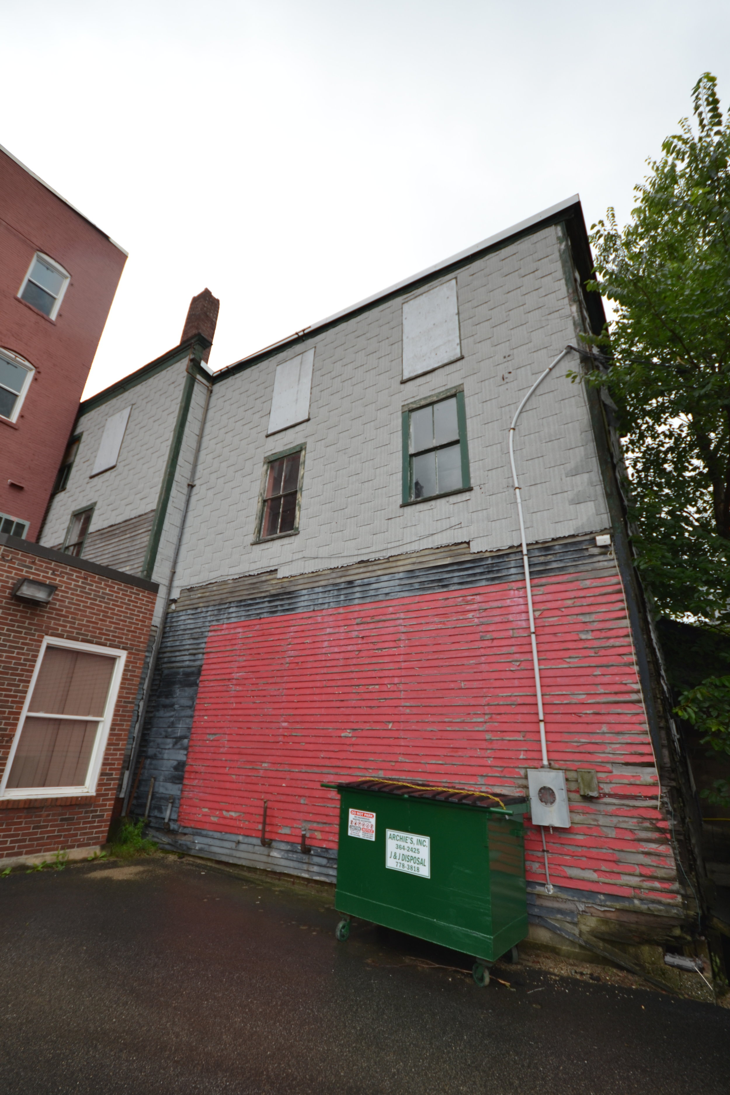
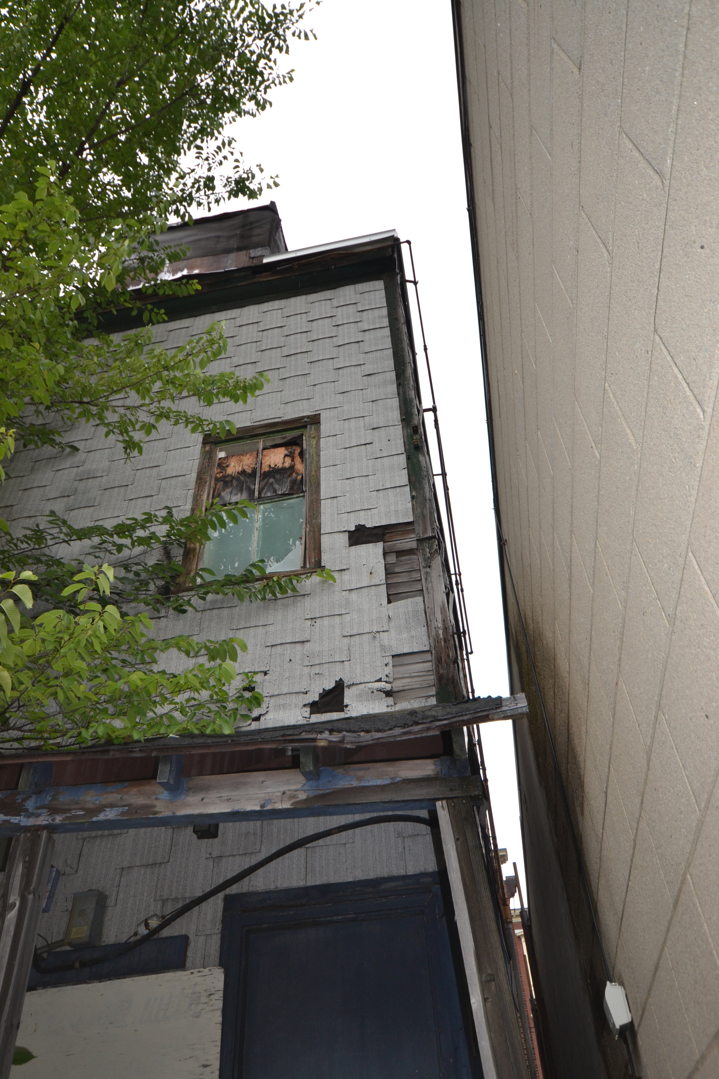
The house requires significant stabilization and rehabilitation work including roof replacement, lead paint, radon, and asbestos abatement, and repair or replacement of windows and siding. There is no heat or central air to the building. The furnace needs replacing and the fuel tank has been removed. There is electricity to the building but it is out of date. In addition, the well and septic system needs to be assessed prior to occupancy. The Lessee will be responsible for all stabilization and rehabilitation expenses to meet Secretary of Interior Standards for the Treatment of Historic Properties.

Learn more about the opportunity here:

Request for Proposal Overview - scroll down for the RFP, images of the house, sample lease, and much more: https://www.nps.gov/articles/mcglashan-nickerson-house.htm

The full details on the opportunity and how to apply: https://www.nps.gov/sacr/getinvolved/dobusinesswithus.htm  

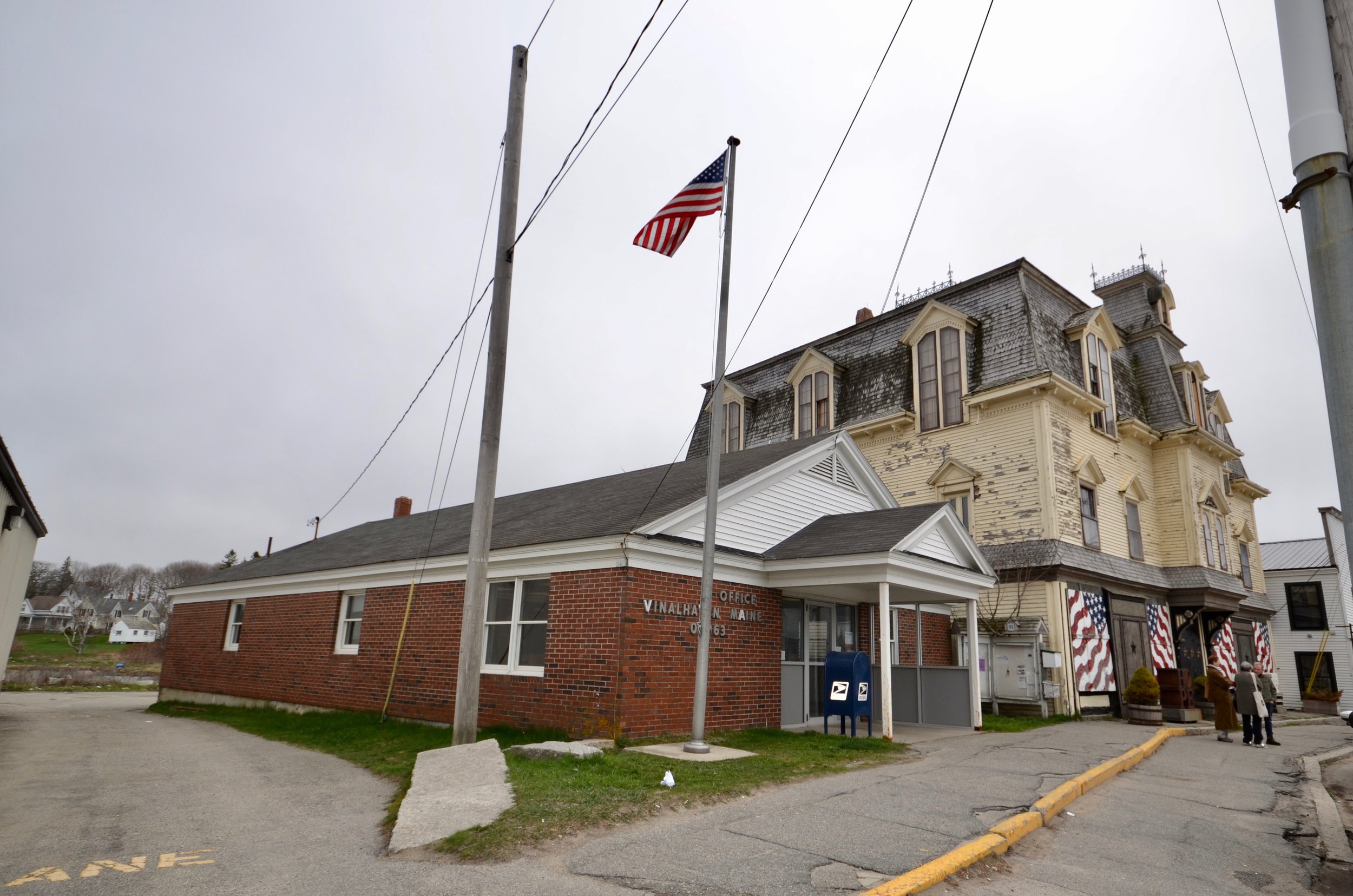
Maine most Endangered Places Citation

The Story

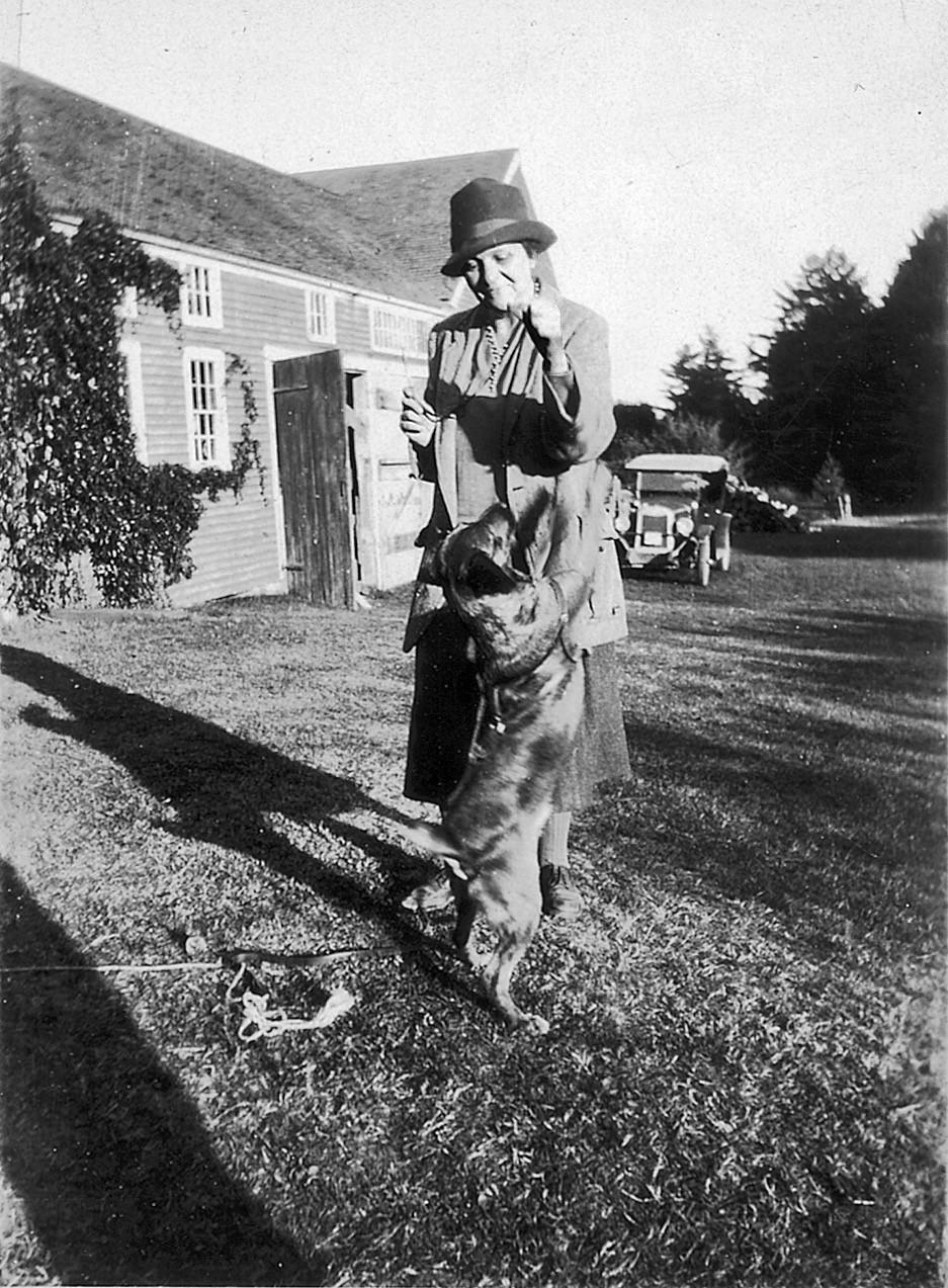
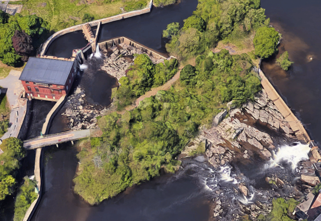
 During the nineteenth century Red Beach was a thriving Calais community built around the now-defunct Maine Red Granite Company and the Red Beach Plaster Company. A survivor of that heyday is  the McGlashan-Nickerson House, constructed in 1883 by Scottish immigrant George G. McGlashan. Acquired shortly thereafter by Calais Justice Samuel H. Nickerson, the rambling two-story Italianate house sports a long ell extending to a carriage barn. The house sits on six acres and is among the largest and most architecturally significant houses in Red Beach and is the only one of Italianate style. It shares a long drive with and the 1854 Gothic Revival Joshua Pettegrove House, that has a landscape designed by a follower of Andrew Jackson Downing., the founder of American landscape architecture. These houses are both individually listed in the National Register of Historic Places and form the southern boundary of the village running upriver to the north. Just downriver, adjoining the McGlashan-Nickerson House property, sits the visitor’s center for the St. Croix International Historic Site, owned by the National Park Service but located well to the east on an island in the St. Croix River.  

The Threat

In 2000 the National Park Service (NPS) acquired and rehabilitated the McGlashan-Nickerson property to house a variety of administrative functions. In 2013 NPS began exploring alternate uses for the property as, after building a new visitor’s center to the south, it no longer needed the house. Sadly, NPS had already stopped painting and repairing the historic residence abdicating its mission to maintain the property. Maine Preservation is surprised that in the just-released Draft Environmental Assessment, the National Park Service stated its preference to dispose of the house WITHOUT the underlying property, requiring any bidder to move the structure. If no bidder willing to initiate a move comes forward,  which NPS acknowledges is likely, the Park Service will demolish the house.

The Solution

For two years Maine Preservation has offered and continues to offer to work with the National Park Service in partnership with the Maine Historic Preservation Commission to find a new owner for the McGlashan-Nickerson House who will stabilize and rehabilitate the house and agree to manage the house in a manner compatible with the adjoining visitor center. For the National Park Service, as the federal agency responsible for our national parks, monuments and all other properties listed in the National Register of Historic Places as well as for the protection of the historic integrity of these places, to demolish this National-Register listed historic house violates its own mission.

Click here to download the citation

Cushman Tavern, Lisbon/Sabattus (LOST)

The Story

Constructed about 1825, Cushman Tavern, was purchased in 1827 by Captain Samuel Cushman who operated it for many years. Listed in the National Register of Historic Places, this house is a significant example of late Federal-style, but its most remarkable features are the Orison Wood painted murals in the first and second story hallways and on the wall of the stairwell between. A follower of Rufus Porter, Wood painted murals in several houses in the area before 1830. From his father he learned plaster painting,  and frescoed at least four houses in West Auburn, Lewiston and Webster Corner with landscapes that are clearly influenced by Porter designs. In an article in the January 22, 1927, issue of the Lewiston Journal, Captain Cushman’s daughter relays the story of how a stranger claiming to be an artist came to the door of the tavern and said that he could,  “paint the walls with marvelous decorations that would advertise the Cushman House far and wide and make its name notable on the lips of the traveling public.” Their rarity and remarkable condition make these murals important examples of early American art.

 The Threat

The tavern, currently vacant, has suffered from severe neglect that includes a failing roof and significant interior water damage. In 1840, when the town of Sabattus split from Lisbon, this property, including the house was split between the two towns, further complicating its status. Unfortunately, both Lisbon and Sabattus have agreed to issue a demolition order citing safety concerns. A contractor has also approached the towns about disassembling the building (while securing the murals) and removing all materials from the site instead of preserving the tavern in place.

The Solution

Maine Preservation is prepared to work with Lisbon and Sabattus—and the property owner—to seek a positive path forward that does not include demolition of the property or removal from the site, and we are willing and able to offer technical assistance and our expertise. We urge the communities to immediately delay the demolition order until there’s been an opportunity to explore the extent of necessary stabilization and rehabilitationand work with the current owner or locate a new owner to preserve it in place.

Click here to download the citation

Clough & Pillsbury Building, Rumford (IN MOTION)

The Story

 In 1916 William Clough, in partnership with Walter Pillsbury, opened a hardware business in the Clough & Pillsbury building in downtown Rumford. A biography of Pillsbury described the business as giving, “the best of service to the community because of its complete assortment of commodities and the efficiency and integrity of its business principles.” One of the few planned company towns in Maine, Rumford boasted a commercial district along the Androscoggin River designed by the Rumford Falls Power Company. The three-story Clough & Pillsbury Building is wood-frame with a brick façade. The storefront is graced with a leaded prismatic glass transom with “Clough & Pillsbury” inset in colored glass. While currently vacant, the building has housed Sherwin-Williams and a thrift store. The upper floors still retain several historic hardware displays and inventory, including cutlery, stoves, tinware, paints, fishing tackle and sporting goods.

 The Threat

 The Town of Rumford took ownership of the property through tax foreclosure in 2009 and unfortunately it remains vacant. During one winter several years ago, a snow plow struck a back corner of the building causing minor and but allowing water to infiltrate the basement. There has been some interest in the building, but there is also talk of demolition. If this building comes down it will remove the opportunity for more commercial and residential development in downtown and leave a gaping hole in the historic streetscape.

 The Solution

Secure a commitment from a developer to rehabilitate this vital structure so it can once again contribute to Rumford’s economic future. Much of the original detailing remains intact throughout the building, most notably on the upper floors. If used as a commercial storefront with upper floor residential apartments that contribute to the National Register district, work could even be eligible for state and federal historic rehabilitation tax credits.

Click here to download the citation